You are here: Home > Network List > II - Global Seismograph Network (GSN - IRIS/IDA) Stations List
> Station MBAR Mbarara, Uganda > Earthquake Result Viewer
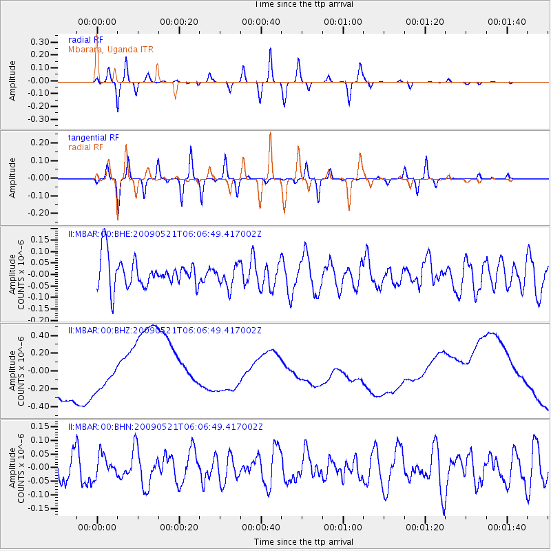
MBAR Mbarara, Uganda - Earthquake Result Viewer
*The percent match for this event was below the threshold and hence no stack was calculated.
| Earthquake location: |
Mindanao, Philippines |
| Earthquake latitude/longitude: |
7.9/126.9 |
| Earthquake time(UTC): |
2009/05/21 (141) 05:53:53 GMT |
| Earthquake Depth: |
14 km |
| Earthquake Magnitude: |
5.5 MB, 5.3 MS, 5.7 MW, 5.7 MW |
| Earthquake Catalog/Contributor: |
WHDF/NEIC |
|
| Network: |
II Global Seismograph Network (GSN - IRIS/IDA) |
| Station: |
MBAR Mbarara, Uganda |
| Lat/Lon: |
0.60 S/30.74 E |
| Elevation: |
1390 m |
|
| Distance: |
96.2 deg |
| Az: |
270.248 deg |
| Baz: |
82.177 deg |
| Ray Param: |
$rayparam |
*The percent match for this event was below the threshold and hence was not used in the summary stack. |
|
| Radial Match: |
22.154755 % |
| Radial Bump: |
400 |
| Transverse Match: |
15.61752 % |
| Transverse Bump: |
400 |
| SOD ConfigId: |
2648 |
| Insert Time: |
2010-03-01 15:12:17.312 +0000 |
| GWidth: |
2.5 |
| Max Bumps: |
400 |
| Tol: |
0.001 |
|
Signal To Noise
| Channel | StoN | STA | LTA |
| II:MBAR:00:BHZ:20090521T06:06:49.417002Z | 0.6877831 | 1.0169483E-7 | 1.4785887E-7 |
| II:MBAR:00:BHN:20090521T06:06:49.417002Z | 0.78775984 | 3.8566654E-8 | 4.895738E-8 |
| II:MBAR:00:BHE:20090521T06:06:49.417002Z | 0.77675253 | 4.9613067E-8 | 6.387243E-8 |
| Arrivals |
| Ps | |
| PpPs | |
| PsPs/PpSs | |


