You are here: Home > Network List > IU - Global Seismograph Network (GSN - IRIS/USGS) Stations List
> Station JOHN Johnston Island, USA > Earthquake Result Viewer
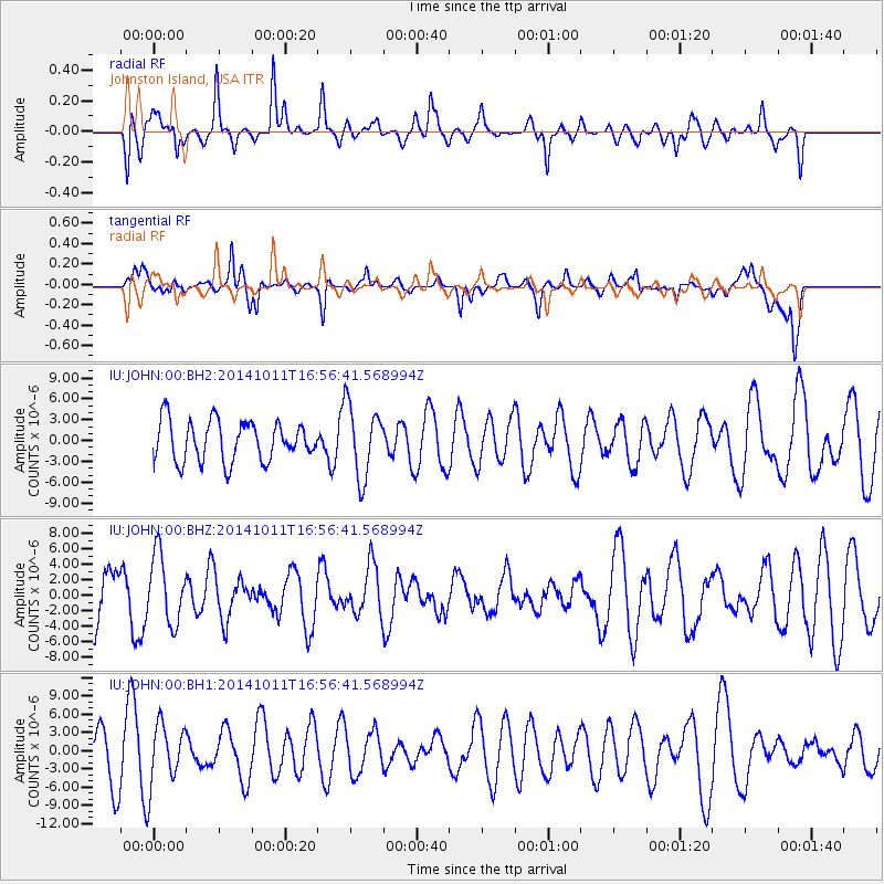
JOHN Johnston Island, USA - Earthquake Result Viewer
*The percent match for this event was below the threshold and hence no stack was calculated.
| Earthquake location: |
Oaxaca, Mexico |
| Earthquake latitude/longitude: |
16.0/-95.6 |
| Earthquake time(UTC): |
2014/10/11 (284) 16:46:02 GMT |
| Earthquake Depth: |
10 km |
| Earthquake Magnitude: |
5.5 MWW, 5.5 MWC |
| Earthquake Catalog/Contributor: |
NEIC PDE/NEIC COMCAT |
|
| Network: |
IU Global Seismograph Network (GSN - IRIS/USGS) |
| Station: |
JOHN Johnston Island, USA |
| Lat/Lon: |
16.73 N/169.53 W |
| Elevation: |
2.0 m |
|
| Distance: |
70.5 deg |
| Az: |
282.387 deg |
| Baz: |
78.588 deg |
| Ray Param: |
$rayparam |
*The percent match for this event was below the threshold and hence was not used in the summary stack. |
|
| Radial Match: |
57.22728 % |
| Radial Bump: |
400 |
| Transverse Match: |
63.618965 % |
| Transverse Bump: |
400 |
| SOD ConfigId: |
3390531 |
| Insert Time: |
2019-04-14 12:03:26.708 +0000 |
| GWidth: |
2.5 |
| Max Bumps: |
400 |
| Tol: |
0.001 |
|
Signal To Noise
| Channel | StoN | STA | LTA |
| IU:JOHN:00:BHZ:20141011T16:56:41.568994Z | 1.344974 | 4.433456E-6 | 3.2963137E-6 |
| IU:JOHN:00:BH1:20141011T16:56:41.568994Z | 1.4673609 | 5.073195E-6 | 3.4573604E-6 |
| IU:JOHN:00:BH2:20141011T16:56:41.568994Z | 0.94379103 | 2.5482282E-6 | 2.6999921E-6 |
| Arrivals |
| Ps | |
| PpPs | |
| PsPs/PpSs | |


