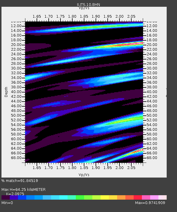
JTS Las Juntas de Abangares, Costa Rica - Earthquake Result Viewer
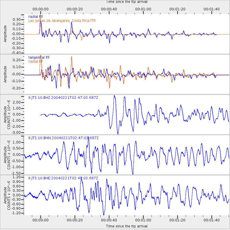
Earthquake location: Southwestern Atlantic Ocean
Earthquake latitude/longitude: -58.4/-15.0
Earthquake time(UTC): 2004/02/21 (052) 02:34:42 GMT
Earthquake Depth: 10 km
Earthquake Magnitude: 6.0 MB, 6.5 MS, 6.6 MW, 6.6 MW
Earthquake Catalog/Contributor: WHDF/NEIC
Network: II Global Seismograph Network (GSN - IRIS/IDA)
Station: JTS Las Juntas de Abangares, Costa Rica
Lat/Lon: 10.29 N/84.95 W
Elevation: 340 m
Distance: 88.5 deg
Az: 292.327 deg
Baz: 150.358 deg
Ray Param: 0.042544123
Estimated Moho Depth: 64.25 km
Estimated Crust Vp/Vs: 2.10
Assumed Crust Vp: 6.597 km/s
Estimated Crust Vs: 3.145 km/s
Estimated Crust Poisson's Ratio: 0.35
Radial Match: 91.84519 %
Radial Bump: 400
Transverse Match: 88.700676 %
Transverse Bump: 400
SOD ConfigId: 2459
Insert Time: 2010-03-01 15:13:16.975 +0000
GWidth: 2.5
Max Bumps: 400
Tol: 0.001

Signal To Noise

ChannelStoNSTALTA
II:JTS:10:BHN:20040221T02:47:03.687Z1.72113412.0139082E-71.1701054E-7
II:JTS:10:BHE:20040221T02:47:03.687Z1.35123651.9282385E-71.4270178E-7
II:JTS:10:BHZ:20040221T02:47:03.687Z2.1678023.029761E-71.3976188E-7
Arrivals
Ps11 SECOND
PpPs30 SECOND
PsPs/PpSs40 SECOND