You are here: Home > Network List > IU - Global Seismograph Network (GSN - IRIS/USGS) Stations List
> Station RSSD Black Hills, South Dakota, USA > Earthquake Result Viewer
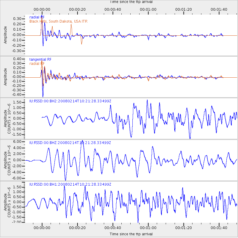
RSSD Black Hills, South Dakota, USA - Earthquake Result Viewer
*The percent match for this event was below the threshold and hence no stack was calculated.
| Earthquake location: |
Southern Greece |
| Earthquake latitude/longitude: |
36.5/21.7 |
| Earthquake time(UTC): |
2008/02/14 (045) 10:09:22 GMT |
| Earthquake Depth: |
29 km |
| Earthquake Magnitude: |
6.9 MW, 6.2 MB, 6.6 MS, 6.7 MW |
| Earthquake Catalog/Contributor: |
NEIC PDE/NEIC PDE-M |
|
| Network: |
IU Global Seismograph Network (GSN - IRIS/USGS) |
| Station: |
RSSD Black Hills, South Dakota, USA |
| Lat/Lon: |
44.12 N/104.04 W |
| Elevation: |
2060 m |
|
| Distance: |
85.9 deg |
| Az: |
324.101 deg |
| Baz: |
40.995 deg |
| Ray Param: |
$rayparam |
*The percent match for this event was below the threshold and hence was not used in the summary stack. |
|
| Radial Match: |
78.03326 % |
| Radial Bump: |
400 |
| Transverse Match: |
73.7686 % |
| Transverse Bump: |
400 |
| SOD ConfigId: |
590571 |
| Insert Time: |
2013-09-26 19:48:07.969 +0000 |
| GWidth: |
2.5 |
| Max Bumps: |
400 |
| Tol: |
0.001 |
|
Signal To Noise
| Channel | StoN | STA | LTA |
| IU:RSSD:00:BHZ:20080214T10:21:28.33499Z | 6.813597 | 1.8809986E-6 | 2.7606544E-7 |
| IU:RSSD:00:BH1:20080214T10:21:28.33499Z | 1.1736413 | 3.354963E-7 | 2.858593E-7 |
| IU:RSSD:00:BH2:20080214T10:21:28.33499Z | 1.1101243 | 2.992182E-7 | 2.6953572E-7 |
| Arrivals |
| Ps | |
| PpPs | |
| PsPs/PpSs | |


