TATO Taipei, Taiwan - Earthquake Result Viewer
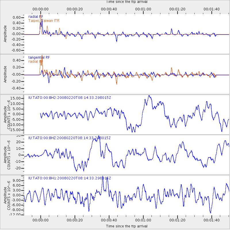
Earthquake location: Off W Coast Of Northern Sumatra
Earthquake latitude/longitude: 2.8/96.0
Earthquake time(UTC): 2008/02/20 (051) 08:08:30 GMT
Earthquake Depth: 26 km
Earthquake Magnitude: 6.5 MB, 7.5 MS, 7.4 MW, 7.4 MW
Earthquake Catalog/Contributor: WHDF/NEIC
Network: IU Global Seismograph Network (GSN - IRIS/USGS)
Station: TATO Taipei, Taiwan
Lat/Lon: 24.98 N/121.49 E
Elevation: 53 m
Distance: 33.1 deg
Az: 45.812 deg
Baz: 232.109 deg
Ray Param: 0.07835035
Estimated Moho Depth: 67.25 km
Estimated Crust Vp/Vs: 1.81
Assumed Crust Vp: 6.289 km/s
Estimated Crust Vs: 3.484 km/s
Estimated Crust Poisson's Ratio: 0.28
Radial Match: 90.97865 %
Radial Bump: 357
Transverse Match: 67.62595 %
Transverse Bump: 400
SOD ConfigId: 590571
Insert Time: 2013-09-26 19:57:48.798 +0000
GWidth: 2.5
Max Bumps: 400
Tol: 0.001

Signal To Noise

ChannelStoNSTALTA
IU:TATO:00:BHZ:20080220T08:14:33.298015Z2.61405664.287052E-61.6399998E-6
IU:TATO:00:BH1:20080220T08:14:33.298015Z1.7548363.3524134E-61.9103857E-6
IU:TATO:00:BH2:20080220T08:14:33.298015Z1.85767273.1673735E-61.7050224E-6
Arrivals
Ps9.3 SECOND
PpPs28 SECOND
PsPs/PpSs37 SECOND