You are here: Home > Network List > TA - USArray Transportable Network (new EarthScope stations) Stations List
> Station P59A Jarrettsville, MD, USA > Earthquake Result Viewer
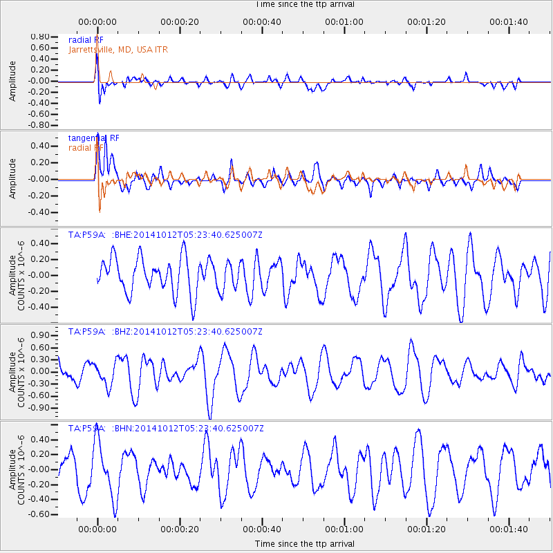
P59A Jarrettsville, MD, USA - Earthquake Result Viewer
*The percent match for this event was below the threshold and hence no stack was calculated.
| Earthquake location: |
Reykjanes Ridge |
| Earthquake latitude/longitude: |
57.4/-33.4 |
| Earthquake time(UTC): |
2014/10/12 (285) 05:17:37 GMT |
| Earthquake Depth: |
16 km |
| Earthquake Magnitude: |
5.3 MW |
| Earthquake Catalog/Contributor: |
ISC/ISC |
|
| Network: |
TA USArray Transportable Network (new EarthScope stations) |
| Station: |
P59A Jarrettsville, MD, USA |
| Lat/Lon: |
39.61 N/76.43 W |
| Elevation: |
157 m |
|
| Distance: |
32.9 deg |
| Az: |
256.146 deg |
| Baz: |
42.94 deg |
| Ray Param: |
$rayparam |
*The percent match for this event was below the threshold and hence was not used in the summary stack. |
|
| Radial Match: |
64.679634 % |
| Radial Bump: |
400 |
| Transverse Match: |
79.15567 % |
| Transverse Bump: |
400 |
| SOD ConfigId: |
3390531 |
| Insert Time: |
2019-04-14 12:16:43.684 +0000 |
| GWidth: |
2.5 |
| Max Bumps: |
400 |
| Tol: |
0.001 |
|
Signal To Noise
| Channel | StoN | STA | LTA |
| TA:P59A: :BHZ:20141012T05:23:40.625007Z | 0.8733987 | 2.8470066E-7 | 3.2596873E-7 |
| TA:P59A: :BHN:20141012T05:23:40.625007Z | 1.6252484 | 3.9788108E-7 | 2.4481247E-7 |
| TA:P59A: :BHE:20141012T05:23:40.625007Z | 0.7971411 | 1.7605825E-7 | 2.208621E-7 |
| Arrivals |
| Ps | |
| PpPs | |
| PsPs/PpSs | |


