You are here: Home > Network List > US - United States National Seismic Network Stations List
> Station KSU1 Kansas State University--Konza Prairie, Kansas, USA > Earthquake Result Viewer
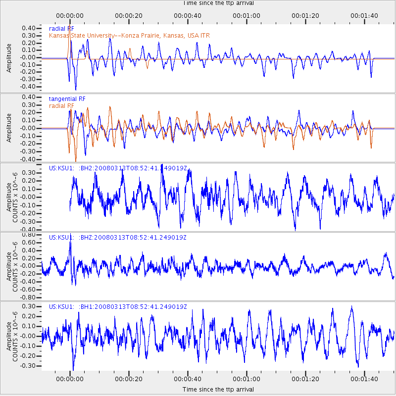
KSU1 Kansas State University--Konza Prairie, Kansas, USA - Earthquake Result Viewer
*The percent match for this event was below the threshold and hence no stack was calculated.
| Earthquake location: |
Kuril Islands |
| Earthquake latitude/longitude: |
43.1/146.5 |
| Earthquake time(UTC): |
2008/03/13 (073) 08:41:07 GMT |
| Earthquake Depth: |
53 km |
| Earthquake Magnitude: |
5.6 MB, 5.4 MW, 5.3 MW |
| Earthquake Catalog/Contributor: |
WHDF/NEIC |
|
| Network: |
US United States National Seismic Network |
| Station: |
KSU1 Kansas State University--Konza Prairie, Kansas, USA |
| Lat/Lon: |
39.10 N/96.61 W |
| Elevation: |
347 m |
|
| Distance: |
80.2 deg |
| Az: |
44.778 deg |
| Baz: |
318.441 deg |
| Ray Param: |
$rayparam |
*The percent match for this event was below the threshold and hence was not used in the summary stack. |
|
| Radial Match: |
42.961754 % |
| Radial Bump: |
400 |
| Transverse Match: |
68.71624 % |
| Transverse Bump: |
400 |
| SOD ConfigId: |
590571 |
| Insert Time: |
2013-09-26 20:50:38.986 +0000 |
| GWidth: |
2.5 |
| Max Bumps: |
400 |
| Tol: |
0.001 |
|
Signal To Noise
| Channel | StoN | STA | LTA |
| US:KSU1: :BHZ:20080313T08:52:41.249019Z | 1.8814408 | 2.5749793E-7 | 1.368621E-7 |
| US:KSU1: :BH1:20080313T08:52:41.249019Z | 1.5635741 | 1.3564701E-7 | 8.6754454E-8 |
| US:KSU1: :BH2:20080313T08:52:41.249019Z | 1.5191777 | 1.889663E-7 | 1.2438723E-7 |
| Arrivals |
| Ps | |
| PpPs | |
| PsPs/PpSs | |


