You are here: Home > Network List > IU - Global Seismograph Network (GSN - IRIS/USGS) Stations List
> Station RSSD Black Hills, South Dakota, USA > Earthquake Result Viewer
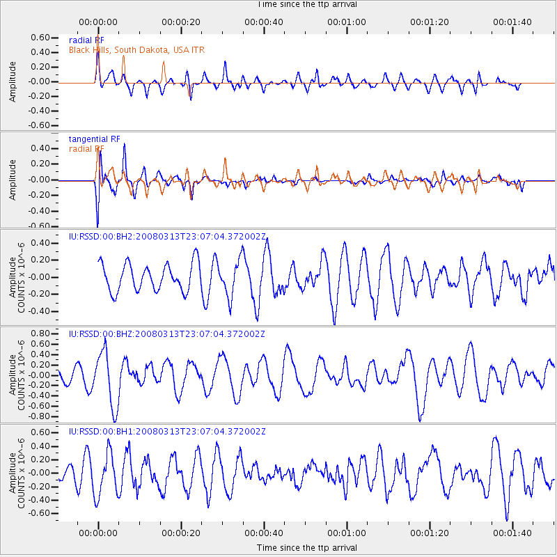
RSSD Black Hills, South Dakota, USA - Earthquake Result Viewer
*The percent match for this event was below the threshold and hence no stack was calculated.
| Earthquake location: |
Near Coast Of Chiapas, Mexico |
| Earthquake latitude/longitude: |
14.5/-93.5 |
| Earthquake time(UTC): |
2008/03/13 (073) 23:01:18 GMT |
| Earthquake Depth: |
10 km |
| Earthquake Magnitude: |
5.7 MW, 5.0 MS, 5.1 MB, 5.5 MW |
| Earthquake Catalog/Contributor: |
WHDF/NEIC |
|
| Network: |
IU Global Seismograph Network (GSN - IRIS/USGS) |
| Station: |
RSSD Black Hills, South Dakota, USA |
| Lat/Lon: |
44.12 N/104.04 W |
| Elevation: |
2060 m |
|
| Distance: |
30.9 deg |
| Az: |
345.089 deg |
| Baz: |
159.751 deg |
| Ray Param: |
$rayparam |
*The percent match for this event was below the threshold and hence was not used in the summary stack. |
|
| Radial Match: |
56.25186 % |
| Radial Bump: |
400 |
| Transverse Match: |
78.61918 % |
| Transverse Bump: |
400 |
| SOD ConfigId: |
590571 |
| Insert Time: |
2013-09-26 20:52:19.228 +0000 |
| GWidth: |
2.5 |
| Max Bumps: |
400 |
| Tol: |
0.001 |
|
Signal To Noise
| Channel | StoN | STA | LTA |
| IU:RSSD:00:BHZ:20080313T23:07:04.372002Z | 2.537974 | 5.516576E-7 | 2.173614E-7 |
| IU:RSSD:00:BH1:20080313T23:07:04.372002Z | 1.8596034 | 3.2128398E-7 | 1.7277016E-7 |
| IU:RSSD:00:BH2:20080313T23:07:04.372002Z | 1.316105 | 2.0785394E-7 | 1.5793113E-7 |
| Arrivals |
| Ps | |
| PpPs | |
| PsPs/PpSs | |


