MSEY Mahe, Seychelles - Earthquake Result Viewer
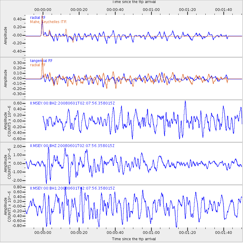
Earthquake location: Philippine Islands Region
Earthquake latitude/longitude: 20.1/121.4
Earthquake time(UTC): 2008/06/01 (153) 01:57:24 GMT
Earthquake Depth: 35 km
Earthquake Magnitude: 6.0 MB, 6.2 MS, 6.3 MW, 6.2 MW
Earthquake Catalog/Contributor: WHDF/NEIC
Network: II Global Seismograph Network (GSN - IRIS/IDA)
Station: MSEY Mahe, Seychelles
Lat/Lon: 4.67 S/55.48 E
Elevation: 475 m
Distance: 69.2 deg
Az: 256.684 deg
Baz: 66.552 deg
Ray Param: 0.055740893
Estimated Moho Depth: 57.5 km
Estimated Crust Vp/Vs: 1.99
Assumed Crust Vp: 6.303 km/s
Estimated Crust Vs: 3.163 km/s
Estimated Crust Poisson's Ratio: 0.33
Radial Match: 81.675766 %
Radial Bump: 338
Transverse Match: 64.664894 %
Transverse Bump: 400
SOD ConfigId: 590571
Insert Time: 2013-09-27 00:01:35.335 +0000
GWidth: 2.5
Max Bumps: 400
Tol: 0.001

Signal To Noise

ChannelStoNSTALTA
II:MSEY:00:BHZ:20080601T02:07:56.358015Z4.7959521.1056527E-62.3053873E-7
II:MSEY:00:BH1:20080601T02:07:56.358015Z2.77468564.3568357E-71.5702088E-7
II:MSEY:00:BH2:20080601T02:07:56.358015Z0.495483228.857636E-81.7876762E-7
Arrivals
Ps9.4 SECOND
PpPs26 SECOND
PsPs/PpSs36 SECOND