You are here: Home > Network List > IU - Global Seismograph Network (GSN - IRIS/USGS) Stations List
> Station RSSD Black Hills, South Dakota, USA > Earthquake Result Viewer
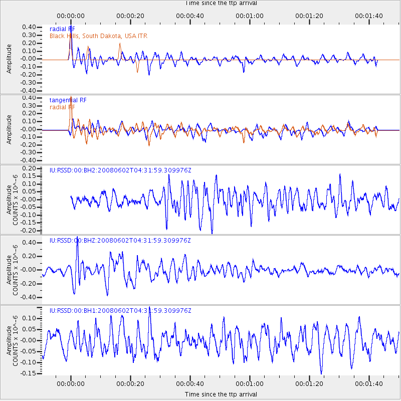
RSSD Black Hills, South Dakota, USA - Earthquake Result Viewer
*The percent match for this event was below the threshold and hence no stack was calculated.
| Earthquake location: |
Tonga Islands |
| Earthquake latitude/longitude: |
-15.2/-173.7 |
| Earthquake time(UTC): |
2008/06/02 (154) 04:19:51 GMT |
| Earthquake Depth: |
35 km |
| Earthquake Magnitude: |
5.6 MW, 5.5 MW |
| Earthquake Catalog/Contributor: |
NEIC PDE/NEIC PDE-M |
|
| Network: |
IU Global Seismograph Network (GSN - IRIS/USGS) |
| Station: |
RSSD Black Hills, South Dakota, USA |
| Lat/Lon: |
44.12 N/104.04 W |
| Elevation: |
2060 m |
|
| Distance: |
86.5 deg |
| Az: |
42.567 deg |
| Baz: |
245.054 deg |
| Ray Param: |
$rayparam |
*The percent match for this event was below the threshold and hence was not used in the summary stack. |
|
| Radial Match: |
71.28966 % |
| Radial Bump: |
400 |
| Transverse Match: |
68.59077 % |
| Transverse Bump: |
400 |
| SOD ConfigId: |
590571 |
| Insert Time: |
2013-09-27 00:06:55.938 +0000 |
| GWidth: |
2.5 |
| Max Bumps: |
400 |
| Tol: |
0.001 |
|
Signal To Noise
| Channel | StoN | STA | LTA |
| IU:RSSD:00:BHZ:20080602T04:31:59.309976Z | 4.1669984 | 2.0140178E-7 | 4.8332577E-8 |
| IU:RSSD:00:BH1:20080602T04:31:59.309976Z | 1.1930614 | 3.905842E-8 | 3.2737983E-8 |
| IU:RSSD:00:BH2:20080602T04:31:59.309976Z | 2.5809188 | 7.516609E-8 | 2.9123774E-8 |
| Arrivals |
| Ps | |
| PpPs | |
| PsPs/PpSs | |


