You are here: Home > Network List > IU - Global Seismograph Network (GSN - IRIS/USGS) Stations List
> Station RSSD Black Hills, South Dakota, USA > Earthquake Result Viewer
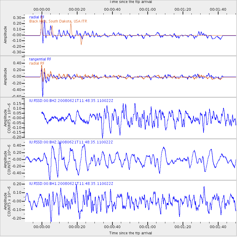
RSSD Black Hills, South Dakota, USA - Earthquake Result Viewer
*The percent match for this event was below the threshold and hence no stack was calculated.
| Earthquake location: |
Southern Greece |
| Earthquake latitude/longitude: |
36.1/21.8 |
| Earthquake time(UTC): |
2008/06/21 (173) 11:36:23 GMT |
| Earthquake Depth: |
5.0 km |
| Earthquake Magnitude: |
5.6 MW, 5.6 MW |
| Earthquake Catalog/Contributor: |
NEIC PDE/NEIC PDE-M |
|
| Network: |
IU Global Seismograph Network (GSN - IRIS/USGS) |
| Station: |
RSSD Black Hills, South Dakota, USA |
| Lat/Lon: |
44.12 N/104.04 W |
| Elevation: |
2060 m |
|
| Distance: |
86.3 deg |
| Az: |
324.2 deg |
| Baz: |
41.155 deg |
| Ray Param: |
$rayparam |
*The percent match for this event was below the threshold and hence was not used in the summary stack. |
|
| Radial Match: |
70.34024 % |
| Radial Bump: |
400 |
| Transverse Match: |
72.35584 % |
| Transverse Bump: |
400 |
| SOD ConfigId: |
590571 |
| Insert Time: |
2013-09-27 00:44:40.170 +0000 |
| GWidth: |
2.5 |
| Max Bumps: |
400 |
| Tol: |
0.001 |
|
Signal To Noise
| Channel | StoN | STA | LTA |
| IU:RSSD:00:BHZ:20080621T11:48:35.110022Z | 4.095602 | 2.2554346E-7 | 5.5069673E-8 |
| IU:RSSD:00:BH1:20080621T11:48:35.110022Z | 0.9201784 | 5.1067914E-8 | 5.5497843E-8 |
| IU:RSSD:00:BH2:20080621T11:48:35.110022Z | 2.324663 | 7.1256245E-8 | 3.065229E-8 |
| Arrivals |
| Ps | |
| PpPs | |
| PsPs/PpSs | |


