You are here: Home > Network List > TA - USArray Transportable Network (new EarthScope stations) Stations List
> Station T56A Rocky Mt, VA, USA > Earthquake Result Viewer
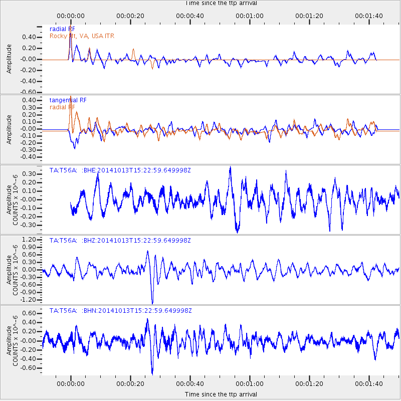
T56A Rocky Mt, VA, USA - Earthquake Result Viewer
*The percent match for this event was below the threshold and hence no stack was calculated.
| Earthquake location: |
Southern Peru |
| Earthquake latitude/longitude: |
-15.3/-73.4 |
| Earthquake time(UTC): |
2014/10/13 (286) 15:14:27 GMT |
| Earthquake Depth: |
92 km |
| Earthquake Magnitude: |
5.4 MW |
| Earthquake Catalog/Contributor: |
ISC/ISC |
|
| Network: |
TA USArray Transportable Network (new EarthScope stations) |
| Station: |
T56A Rocky Mt, VA, USA |
| Lat/Lon: |
37.03 N/80.03 W |
| Elevation: |
387 m |
|
| Distance: |
52.4 deg |
| Az: |
353.327 deg |
| Baz: |
171.945 deg |
| Ray Param: |
$rayparam |
*The percent match for this event was below the threshold and hence was not used in the summary stack. |
|
| Radial Match: |
75.27796 % |
| Radial Bump: |
400 |
| Transverse Match: |
64.78504 % |
| Transverse Bump: |
400 |
| SOD ConfigId: |
3390531 |
| Insert Time: |
2019-04-14 13:03:33.458 +0000 |
| GWidth: |
2.5 |
| Max Bumps: |
400 |
| Tol: |
0.001 |
|
Signal To Noise
| Channel | StoN | STA | LTA |
| TA:T56A: :BHZ:20141013T15:22:59.649998Z | 2.9605918 | 2.7034903E-7 | 9.1315876E-8 |
| TA:T56A: :BHN:20141013T15:22:59.649998Z | 1.4660703 | 1.5710772E-7 | 1.0716247E-7 |
| TA:T56A: :BHE:20141013T15:22:59.649998Z | 0.8123176 | 9.227924E-8 | 1.13599945E-7 |
| Arrivals |
| Ps | |
| PpPs | |
| PsPs/PpSs | |


