MSEY Mahe, Seychelles - Earthquake Result Viewer
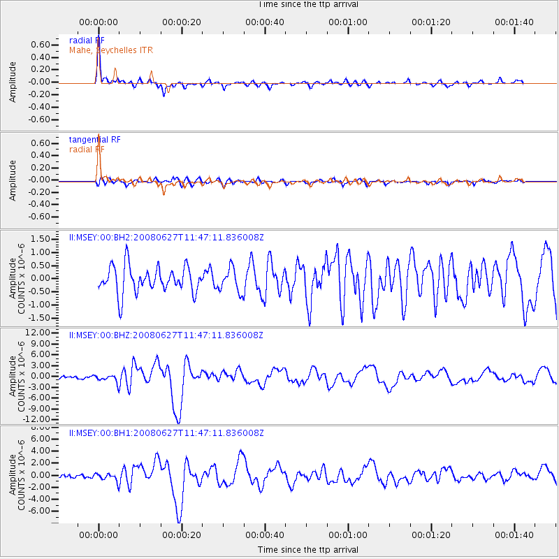
Earthquake location: Andaman Islands, India Region
Earthquake latitude/longitude: 11.0/91.8
Earthquake time(UTC): 2008/06/27 (179) 11:40:13 GMT
Earthquake Depth: 17 km
Earthquake Magnitude: 6.4 MB, 6.7 MS, 6.6 MW, 6.6 MW
Earthquake Catalog/Contributor: WHDF/NEIC
Network: II Global Seismograph Network (GSN - IRIS/IDA)
Station: MSEY Mahe, Seychelles
Lat/Lon: 4.67 S/55.48 E
Elevation: 475 m
Distance: 39.4 deg
Az: 248.58 deg
Baz: 66.497 deg
Ray Param: 0.07499721
Estimated Moho Depth: 31.5 km
Estimated Crust Vp/Vs: 1.65
Assumed Crust Vp: 6.303 km/s
Estimated Crust Vs: 3.808 km/s
Estimated Crust Poisson's Ratio: 0.21
Radial Match: 88.61744 %
Radial Bump: 394
Transverse Match: 67.40883 %
Transverse Bump: 400
SOD ConfigId: 590571
Insert Time: 2013-09-27 00:56:15.390 +0000
GWidth: 2.5
Max Bumps: 400
Tol: 0.001

Signal To Noise

ChannelStoNSTALTA
II:MSEY:00:BHZ:20080627T11:47:11.836008Z1.76488731.1367737E-66.441055E-7
II:MSEY:00:BH1:20080627T11:47:11.836008Z1.84611526.9197756E-73.74829E-7
II:MSEY:00:BH2:20080627T11:47:11.836008Z0.93137724.617319E-74.957518E-7
Arrivals
Ps3.5 SECOND
PpPs12 SECOND
PsPs/PpSs16 SECOND