RSSD Black Hills, South Dakota, USA - Earthquake Result Viewer
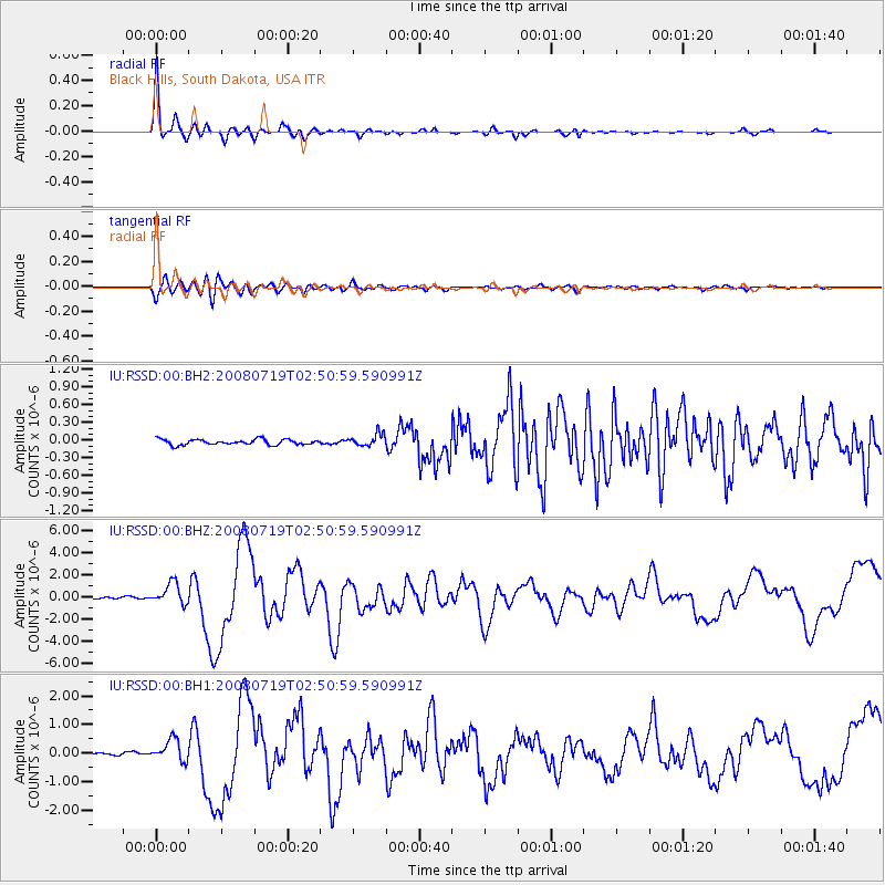
Earthquake location: Off East Coast Of Honshu, Japan
Earthquake latitude/longitude: 37.6/142.2
Earthquake time(UTC): 2008/07/19 (201) 02:39:28 GMT
Earthquake Depth: 22 km
Earthquake Magnitude: 6.2 MB, 7.0 MS, 7.0 MW, 6.9 MW
Earthquake Catalog/Contributor: WHDF/NEIC
Network: IU Global Seismograph Network (GSN - IRIS/USGS)
Station: RSSD Black Hills, South Dakota, USA
Lat/Lon: 44.12 N/104.04 W
Elevation: 2060 m
Distance: 79.0 deg
Az: 42.184 deg
Baz: 312.18 deg
Ray Param: 0.049226575
Estimated Moho Depth: 16.0 km
Estimated Crust Vp/Vs: 2.09
Assumed Crust Vp: 6.242 km/s
Estimated Crust Vs: 2.987 km/s
Estimated Crust Poisson's Ratio: 0.35
Radial Match: 98.33176 %
Radial Bump: 262
Transverse Match: 90.482925 %
Transverse Bump: 400
SOD ConfigId: 590571
Insert Time: 2013-09-27 01:39:45.283 +0000
GWidth: 2.5
Max Bumps: 400
Tol: 0.001

Signal To Noise

ChannelStoNSTALTA
IU:RSSD:00:BHZ:20080719T02:50:59.590991Z15.9149479.496097E-75.966779E-8
IU:RSSD:00:BH1:20080719T02:50:59.590991Z8.1473873.8413353E-74.7148067E-8
IU:RSSD:00:BH2:20080719T02:50:59.590991Z2.23220561.0275982E-74.60351E-8
Arrivals
Ps2.9 SECOND
PpPs7.7 SECOND
PsPs/PpSs11 SECOND