
AAK Ala Archa, Kyrgyzstan - Earthquake Result Viewer
| ||||||||||||||||||
| ||||||||||||||||||
| ||||||||||||||||||
|
Signal To Noise
| Channel | StoN | STA | LTA |
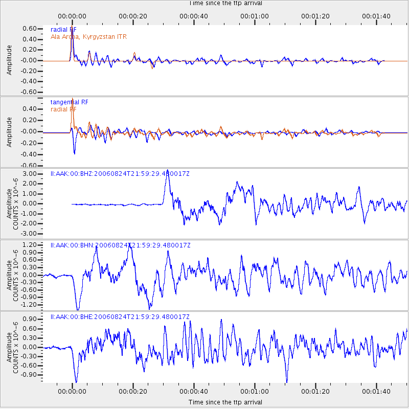
| II:AAK:00:BHN:20060824T21:59:29.480017Z | 27.452732 | 7.0778555E-7 | 2.578197E-8 |
| II:AAK:00:BHE:20060824T21:59:29.480017Z | 18.8409 | 4.987198E-7 | 2.6470063E-8 |
| II:AAK:00:BHZ:20060824T21:59:29.480017Z | 38.47539 | 1.5668069E-6 | 4.072231E-8 |
| Arrivals | |
| Ps | 5.7 SECOND |
| PpPs | 21 SECOND |
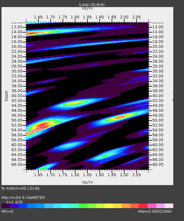
| PsPs/PpSs | 27 SECOND |

