You are here: Home > Network List > IW - Intermountain West Stations List
> Station MOOW Moose Ponds, Wyoming, USA > Earthquake Result Viewer
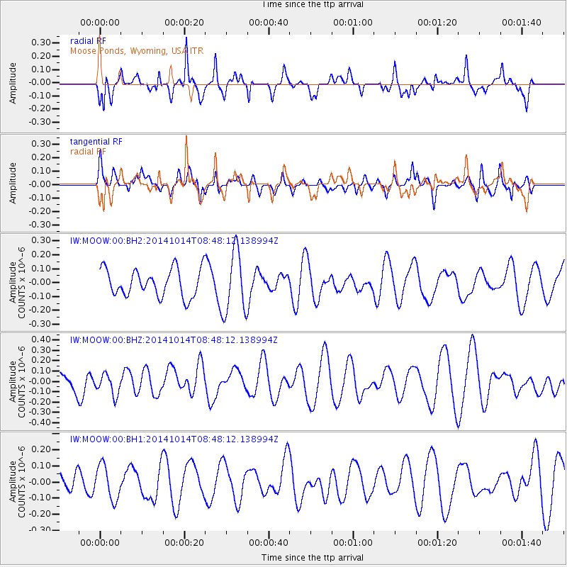
MOOW Moose Ponds, Wyoming, USA - Earthquake Result Viewer
*The percent match for this event was below the threshold and hence no stack was calculated.
| Earthquake location: |
Kermadec Islands, New Zealand |
| Earthquake latitude/longitude: |
-30.0/-177.4 |
| Earthquake time(UTC): |
2014/10/14 (287) 08:35:22 GMT |
| Earthquake Depth: |
35 km |
| Earthquake Magnitude: |
5.2 mb |
| Earthquake Catalog/Contributor: |
ISC/ISC |
|
| Network: |
IW Intermountain West |
| Station: |
MOOW Moose Ponds, Wyoming, USA |
| Lat/Lon: |
43.75 N/110.74 W |
| Elevation: |
2128 m |
|
| Distance: |
95.4 deg |
| Az: |
41.919 deg |
| Baz: |
233.095 deg |
| Ray Param: |
$rayparam |
*The percent match for this event was below the threshold and hence was not used in the summary stack. |
|
| Radial Match: |
62.486927 % |
| Radial Bump: |
340 |
| Transverse Match: |
35.916573 % |
| Transverse Bump: |
400 |
| SOD ConfigId: |
3390531 |
| Insert Time: |
2019-04-14 13:30:23.970 +0000 |
| GWidth: |
2.5 |
| Max Bumps: |
400 |
| Tol: |
0.001 |
|
Signal To Noise
| Channel | StoN | STA | LTA |
| IW:MOOW:00:BHZ:20141014T08:48:12.138994Z | 0.89892375 | 1.05028455E-7 | 1.16837995E-7 |
| IW:MOOW:00:BH1:20141014T08:48:12.138994Z | 1.0353756 | 1.0894969E-7 | 1.0522721E-7 |
| IW:MOOW:00:BH2:20141014T08:48:12.138994Z | 2.3024492 | 2.2601513E-7 | 9.8162914E-8 |
| Arrivals |
| Ps | |
| PpPs | |
| PsPs/PpSs | |


