You are here: Home > Network List > IU - Global Seismograph Network (GSN - IRIS/USGS) Stations List
> Station RSSD Black Hills, South Dakota, USA > Earthquake Result Viewer
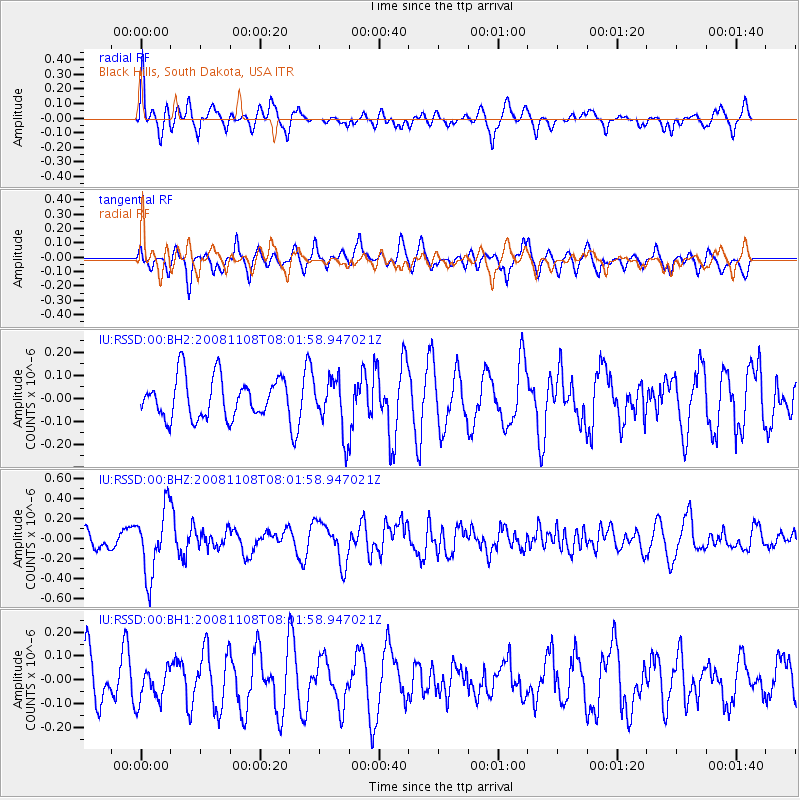
RSSD Black Hills, South Dakota, USA - Earthquake Result Viewer
*The percent match for this event was below the threshold and hence no stack was calculated.
| Earthquake location: |
Tonga Islands |
| Earthquake latitude/longitude: |
-15.2/-174.2 |
| Earthquake time(UTC): |
2008/11/08 (313) 07:49:59 GMT |
| Earthquake Depth: |
121 km |
| Earthquake Magnitude: |
6.0 MW, 5.4 MB, 6.0 MW |
| Earthquake Catalog/Contributor: |
WHDF/NEIC |
|
| Network: |
IU Global Seismograph Network (GSN - IRIS/USGS) |
| Station: |
RSSD Black Hills, South Dakota, USA |
| Lat/Lon: |
44.12 N/104.04 W |
| Elevation: |
2060 m |
|
| Distance: |
86.9 deg |
| Az: |
42.736 deg |
| Baz: |
245.452 deg |
| Ray Param: |
$rayparam |
*The percent match for this event was below the threshold and hence was not used in the summary stack. |
|
| Radial Match: |
59.67814 % |
| Radial Bump: |
400 |
| Transverse Match: |
63.554512 % |
| Transverse Bump: |
400 |
| SOD ConfigId: |
590571 |
| Insert Time: |
2013-09-27 05:56:13.215 +0000 |
| GWidth: |
2.5 |
| Max Bumps: |
400 |
| Tol: |
0.001 |
|
Signal To Noise
| Channel | StoN | STA | LTA |
| IU:RSSD:00:BHZ:20081108T08:01:58.947021Z | 3.7433934 | 3.3319236E-7 | 8.9008104E-8 |
| IU:RSSD:00:BH1:20081108T08:01:58.947021Z | 0.77257305 | 7.1557665E-8 | 9.262252E-8 |
| IU:RSSD:00:BH2:20081108T08:01:58.947021Z | 1.3688513 | 1.1859771E-7 | 8.664032E-8 |
| Arrivals |
| Ps | |
| PpPs | |
| PsPs/PpSs | |


