You are here: Home > Network List > CN - Canadian National Seismograph Network Stations List
> Station INK INUVIK, NT > Earthquake Result Viewer
INK INUVIK, NT - Earthquake Result Viewer
*The percent match for this event was below the threshold and hence no stack was calculated.
| Earthquake location: |
Ryukyu Islands, Japan |
| Earthquake latitude/longitude: |
26.3/127.4 |
| Earthquake time(UTC): |
2014/10/14 (287) 22:52:10 GMT |
| Earthquake Depth: |
53 km |
| Earthquake Magnitude: |
5.2 MW |
| Earthquake Catalog/Contributor: |
ISC/ISC |
|
| Network: |
CN Canadian National Seismograph Network |
| Station: |
INK INUVIK, NT |
| Lat/Lon: |
68.31 N/133.53 W |
| Elevation: |
44 m |
|
| Distance: |
69.1 deg |
| Az: |
23.137 deg |
| Baz: |
288.387 deg |
| Ray Param: |
$rayparam |
*The percent match for this event was below the threshold and hence was not used in the summary stack. |
|
| Radial Match: |
62.661316 % |
| Radial Bump: |
400 |
| Transverse Match: |
61.745132 % |
| Transverse Bump: |
400 |
| SOD ConfigId: |
3390531 |
| Insert Time: |
2019-04-14 13:46:32.416 +0000 |
| GWidth: |
2.5 |
| Max Bumps: |
400 |
| Tol: |
0.001 |
|
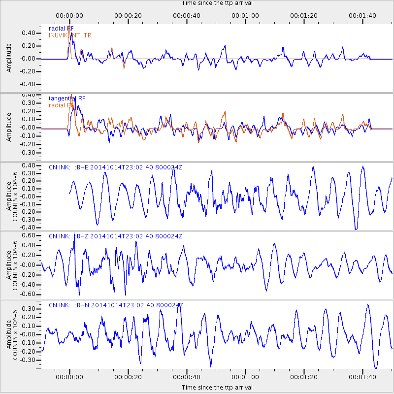
Signal To Noise
| Channel | StoN | STA | LTA |
| CN:INK: :BHZ:20141014T23:02:40.800024Z | 3.5670621 | 3.3198936E-7 | 9.30708E-8 |
| CN:INK: :BHN:20141014T23:02:40.800024Z | 0.6032329 | 5.2502063E-8 | 8.703448E-8 |
| CN:INK: :BHE:20141014T23:02:40.800024Z | 0.88293946 | 1.424708E-7 | 1.6135964E-7 |
| Arrivals |
| Ps | |
| PpPs | |
| PsPs/PpSs | |


