You are here: Home > Network List > IU - Global Seismograph Network (GSN - IRIS/USGS) Stations List
> Station RSSD Black Hills, South Dakota, USA > Earthquake Result Viewer
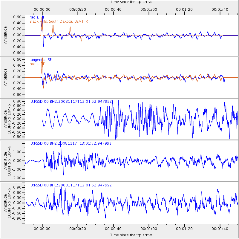
RSSD Black Hills, South Dakota, USA - Earthquake Result Viewer
*The percent match for this event was below the threshold and hence no stack was calculated.
| Earthquake location: |
Arctic Ocean |
| Earthquake latitude/longitude: |
79.6/-116.1 |
| Earthquake time(UTC): |
2008/11/17 (322) 12:55:22 GMT |
| Earthquake Depth: |
7.0 km |
| Earthquake Magnitude: |
5.7 MW, 5.2 MS, 5.4 MB, 5.7 MW |
| Earthquake Catalog/Contributor: |
WHDF/NEIC |
|
| Network: |
IU Global Seismograph Network (GSN - IRIS/USGS) |
| Station: |
RSSD Black Hills, South Dakota, USA |
| Lat/Lon: |
44.12 N/104.04 W |
| Elevation: |
2060 m |
|
| Distance: |
35.9 deg |
| Az: |
165.192 deg |
| Baz: |
356.32 deg |
| Ray Param: |
$rayparam |
*The percent match for this event was below the threshold and hence was not used in the summary stack. |
|
| Radial Match: |
70.009056 % |
| Radial Bump: |
400 |
| Transverse Match: |
60.00004 % |
| Transverse Bump: |
400 |
| SOD ConfigId: |
590571 |
| Insert Time: |
2013-09-27 06:13:12.120 +0000 |
| GWidth: |
2.5 |
| Max Bumps: |
400 |
| Tol: |
0.001 |
|
Signal To Noise
| Channel | StoN | STA | LTA |
| IU:RSSD:00:BHZ:20081117T13:01:52.94799Z | 1.8449152 | 4.1767404E-7 | 2.2639202E-7 |
| IU:RSSD:00:BH1:20081117T13:01:52.94799Z | 1.684104 | 2.2199275E-7 | 1.3181653E-7 |
| IU:RSSD:00:BH2:20081117T13:01:52.94799Z | 1.0707291 | 2.2103713E-7 | 2.0643607E-7 |
| Arrivals |
| Ps | |
| PpPs | |
| PsPs/PpSs | |


