You are here: Home > Network List > IU - Global Seismograph Network (GSN - IRIS/USGS) Stations List
> Station RSSD Black Hills, South Dakota, USA > Earthquake Result Viewer
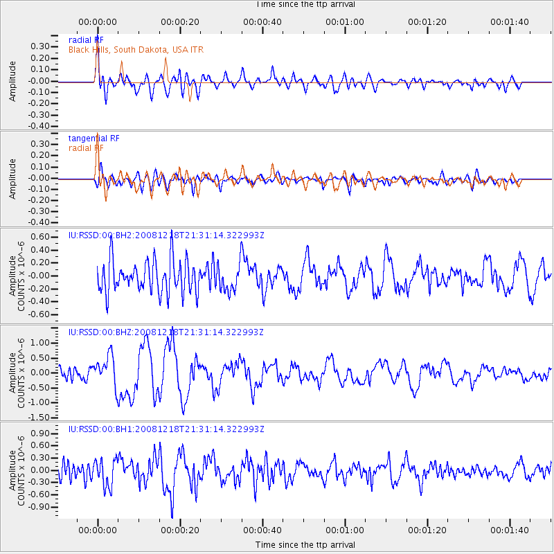
RSSD Black Hills, South Dakota, USA - Earthquake Result Viewer
*The percent match for this event was below the threshold and hence no stack was calculated.
| Earthquake location: |
Near Coast Of Central Chile |
| Earthquake latitude/longitude: |
-32.5/-71.7 |
| Earthquake time(UTC): |
2008/12/18 (353) 21:19:28 GMT |
| Earthquake Depth: |
18 km |
| Earthquake Magnitude: |
5.8 MB, 6.0 MS, 6.2 MW, 6.1 MW |
| Earthquake Catalog/Contributor: |
WHDF/NEIC |
|
| Network: |
IU Global Seismograph Network (GSN - IRIS/USGS) |
| Station: |
RSSD Black Hills, South Dakota, USA |
| Lat/Lon: |
44.12 N/104.04 W |
| Elevation: |
2060 m |
|
| Distance: |
81.7 deg |
| Az: |
337.107 deg |
| Baz: |
152.83 deg |
| Ray Param: |
$rayparam |
*The percent match for this event was below the threshold and hence was not used in the summary stack. |
|
| Radial Match: |
75.968185 % |
| Radial Bump: |
400 |
| Transverse Match: |
56.26361 % |
| Transverse Bump: |
400 |
| SOD ConfigId: |
590571 |
| Insert Time: |
2013-09-27 07:57:53.032 +0000 |
| GWidth: |
2.5 |
| Max Bumps: |
400 |
| Tol: |
0.001 |
|
Signal To Noise
| Channel | StoN | STA | LTA |
| IU:RSSD:00:BHZ:20081218T21:31:14.322993Z | 2.1675315 | 5.2281615E-7 | 2.4120348E-7 |
| IU:RSSD:00:BH1:20081218T21:31:14.322993Z | 1.4088947 | 3.3369216E-7 | 2.3684676E-7 |
| IU:RSSD:00:BH2:20081218T21:31:14.322993Z | 0.85799706 | 2.1373509E-7 | 2.4910935E-7 |
| Arrivals |
| Ps | |
| PpPs | |
| PsPs/PpSs | |


