You are here: Home > Network List > II - Global Seismograph Network (GSN - IRIS/IDA) Stations List
> Station MSEY Mahe, Seychelles > Earthquake Result Viewer
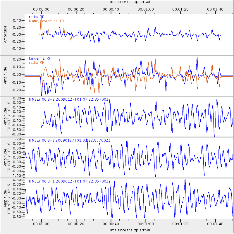
MSEY Mahe, Seychelles - Earthquake Result Viewer
*The percent match for this event was below the threshold and hence no stack was calculated.
| Earthquake location: |
South Of Sumbawa, Indonesia |
| Earthquake latitude/longitude: |
-11.4/117.6 |
| Earthquake time(UTC): |
2009/01/27 (027) 00:57:35 GMT |
| Earthquake Depth: |
12 km |
| Earthquake Magnitude: |
5.5 MB |
| Earthquake Catalog/Contributor: |
NEIC PDE/NEIC PDE-M |
|
| Network: |
II Global Seismograph Network (GSN - IRIS/IDA) |
| Station: |
MSEY Mahe, Seychelles |
| Lat/Lon: |
4.67 S/55.48 E |
| Elevation: |
475 m |
|
| Distance: |
61.7 deg |
| Az: |
270.79 deg |
| Baz: |
100.349 deg |
| Ray Param: |
$rayparam |
*The percent match for this event was below the threshold and hence was not used in the summary stack. |
|
| Radial Match: |
55.4309 % |
| Radial Bump: |
400 |
| Transverse Match: |
58.566128 % |
| Transverse Bump: |
400 |
| SOD ConfigId: |
590571 |
| Insert Time: |
2013-09-27 09:45:28.070 +0000 |
| GWidth: |
2.5 |
| Max Bumps: |
400 |
| Tol: |
0.001 |
|
Signal To Noise
| Channel | StoN | STA | LTA |
| II:MSEY:00:BHZ:20090127T01:07:22.857002Z | 0.70907694 | 2.8441838E-7 | 4.0111075E-7 |
| II:MSEY:00:BH1:20090127T01:07:22.857002Z | 1.123002 | 3.5644032E-7 | 3.1739953E-7 |
| II:MSEY:00:BH2:20090127T01:07:22.857002Z | 0.9505351 | 2.7239426E-7 | 2.865694E-7 |
| Arrivals |
| Ps | |
| PpPs | |
| PsPs/PpSs | |


