You are here: Home > Network List > IU - Global Seismograph Network (GSN - IRIS/USGS) Stations List
> Station RSSD Black Hills, South Dakota, USA > Earthquake Result Viewer
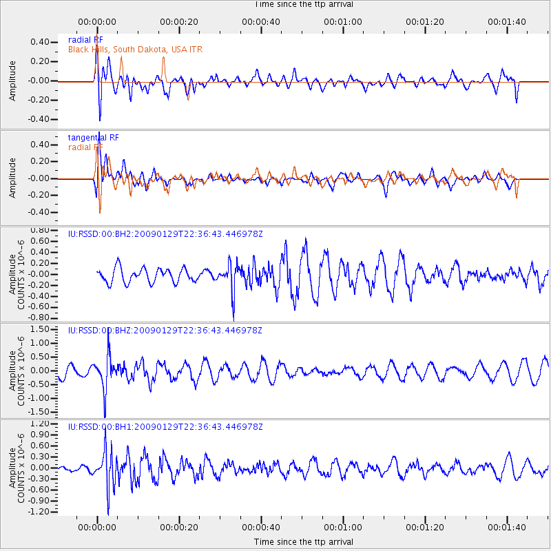
RSSD Black Hills, South Dakota, USA - Earthquake Result Viewer
*The percent match for this event was below the threshold and hence no stack was calculated.
| Earthquake location: |
Western Brazil |
| Earthquake latitude/longitude: |
-8.1/-71.4 |
| Earthquake time(UTC): |
2009/01/29 (029) 22:28:05 GMT |
| Earthquake Depth: |
602 km |
| Earthquake Magnitude: |
5.7 MW, 5.3 MB, 5.6 MW |
| Earthquake Catalog/Contributor: |
WHDF/NEIC |
|
| Network: |
IU Global Seismograph Network (GSN - IRIS/USGS) |
| Station: |
RSSD Black Hills, South Dakota, USA |
| Lat/Lon: |
44.12 N/104.04 W |
| Elevation: |
2060 m |
|
| Distance: |
59.8 deg |
| Az: |
333.29 deg |
| Baz: |
141.835 deg |
| Ray Param: |
$rayparam |
*The percent match for this event was below the threshold and hence was not used in the summary stack. |
|
| Radial Match: |
59.23076 % |
| Radial Bump: |
400 |
| Transverse Match: |
67.26912 % |
| Transverse Bump: |
400 |
| SOD ConfigId: |
590571 |
| Insert Time: |
2013-09-27 09:52:01.983 +0000 |
| GWidth: |
2.5 |
| Max Bumps: |
400 |
| Tol: |
0.001 |
|
Signal To Noise
| Channel | StoN | STA | LTA |
| IU:RSSD:00:BHZ:20090129T22:36:43.446978Z | 3.5604975 | 6.0115576E-7 | 1.6884039E-7 |
| IU:RSSD:00:BH1:20090129T22:36:43.446978Z | 4.527223 | 4.7351878E-7 | 1.0459364E-7 |
| IU:RSSD:00:BH2:20090129T22:36:43.446978Z | 1.9842446 | 2.4986466E-7 | 1.2592433E-7 |
| Arrivals |
| Ps | |
| PpPs | |
| PsPs/PpSs | |


