You are here: Home > Network List > II - Global Seismograph Network (GSN - IRIS/IDA) Stations List
> Station AAK Ala Archa, Kyrgyzstan > Earthquake Result Viewer
AAK Ala Archa, Kyrgyzstan - Earthquake Result Viewer

| Earthquake location: |
Sulawesi, Indonesia |
| Earthquake latitude/longitude: |
-1.1/123.6 |
| Earthquake time(UTC): |
2000/05/04 (125) 04:21:16 GMT |
| Earthquake Depth: |
26 km |
| Earthquake Magnitude: |
6.7 MB, 7.5 MS, 7.6 MW, 7.5 ME |
| Earthquake Catalog/Contributor: |
WHDF/NEIC |
|
| Network: |
II Global Seismograph Network (GSN - IRIS/IDA) |
| Station: |
AAK Ala Archa, Kyrgyzstan |
| Lat/Lon: |
42.64 N/74.49 E |
| Elevation: |
1645 m |
|
| Distance: |
61.9 deg |
| Az: |
320.817 deg |
| Baz: |
121.122 deg |
| Ray Param: |
0.060514893 |
| Estimated Moho Depth: |
17.5 km |
| Estimated Crust Vp/Vs: |
1.73 |
| Assumed Crust Vp: |
6.306 km/s |
| Estimated Crust Vs: |
3.65 km/s |
| Estimated Crust Poisson's Ratio: |
0.25 |
|
| Radial Match: |
93.73709 % |
| Radial Bump: |
400 |
| Transverse Match: |
78.732285 % |
| Transverse Bump: |
400 |
| SOD ConfigId: |
3744 |
| Insert Time: |
2010-03-01 15:21:00.416 +0000 |
| GWidth: |
2.5 |
| Max Bumps: |
400 |
| Tol: |
0.001 |
|
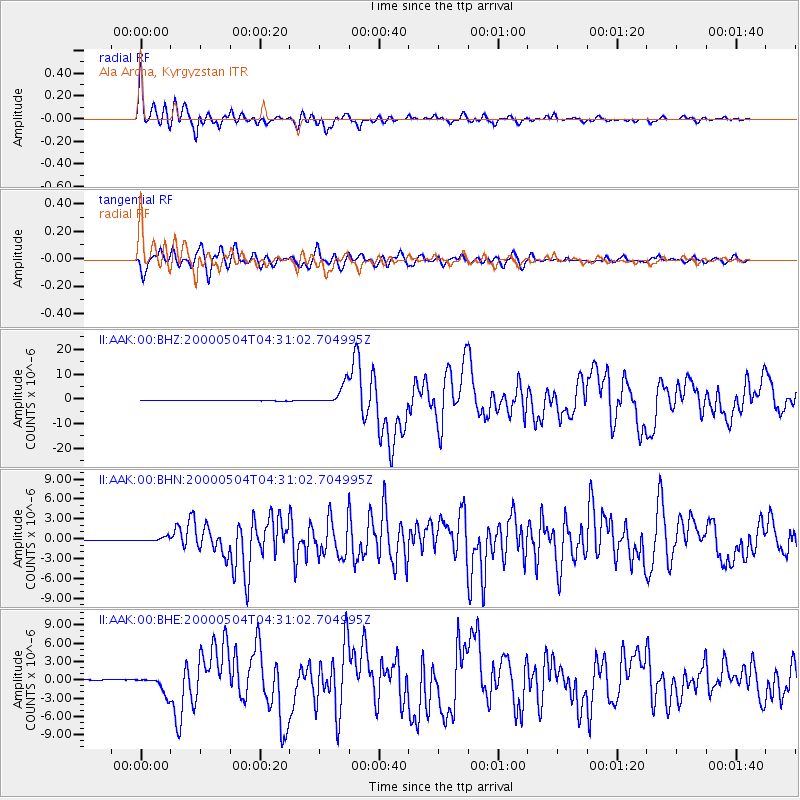
Signal To Noise
| Channel | StoN | STA | LTA |
| II:AAK:00:BHN:20000504T04:31:02.704995Z | 8.218239 | 2.85925E-7 | 3.479152E-8 |
| II:AAK:00:BHE:20000504T04:31:02.704995Z | 23.91373 | 1.4501767E-6 | 6.064201E-8 |
| II:AAK:00:BHZ:20000504T04:31:02.704995Z | 35.053577 | 4.104574E-6 | 1.17094295E-7 |
| Arrivals |
| Ps | 2.1 SECOND |
| PpPs | 7.2 SECOND |
| PsPs/PpSs | 9.4 SECOND |


