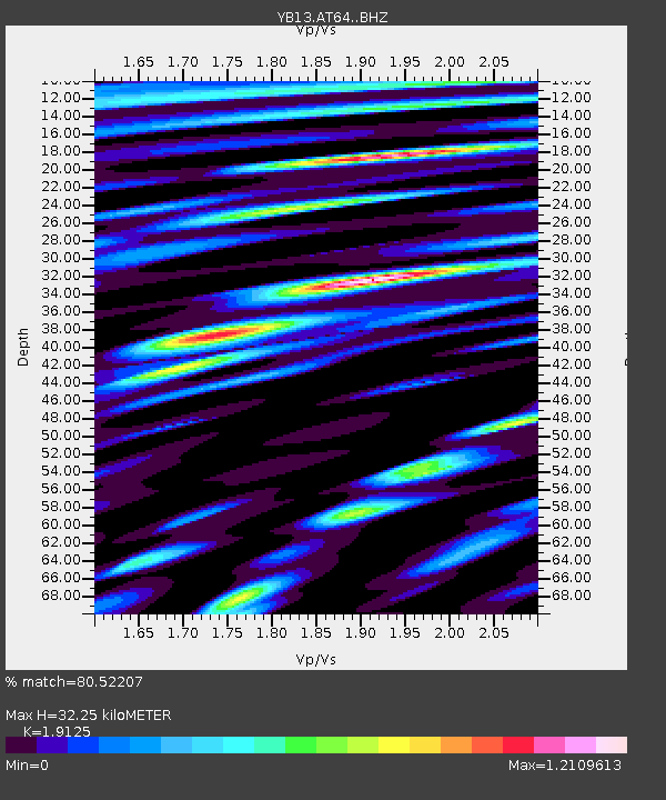
AT64 Esenpinar,Mersin,Turkey - Earthquake Result Viewer

Earthquake location: Southeast Of Honshu, Japan
Earthquake latitude/longitude: 31.7/140.5
Earthquake time(UTC): 2014/10/15 (288) 23:53:01 GMT
Earthquake Depth: 58 km
Earthquake Magnitude: 5.5 MWW, 5.5 MWC, 5.6 MWB
Earthquake Catalog/Contributor: NEIC PDE/NEIC COMCAT
Network: YB Continental Dynamics/Cent. Anatolian Tectonics:Surface to Mantle Dynamics During
Station: AT64 Esenpinar,Mersin,Turkey
Lat/Lon: 36.60 N/34.12 E
Elevation: 874 m
Distance: 83.3 deg
Az: 308.98 deg
Baz: 55.386 deg
Ray Param: 0.04620739
Estimated Moho Depth: 32.25 km
Estimated Crust Vp/Vs: 1.91
Assumed Crust Vp: 6.247 km/s
Estimated Crust Vs: 3.266 km/s
Estimated Crust Poisson's Ratio: 0.31
Radial Match: 80.52207 %
Radial Bump: 400
Transverse Match: 83.10485 %
Transverse Bump: 400
SOD ConfigId: 3390531
Insert Time: 2019-04-14 14:17:15.376 +0000
GWidth: 2.5
Max Bumps: 400
Tol: 0.001

Signal To Noise

ChannelStoNSTALTA
YB:AT64: :BHZ:20141016T00:04:50.779978Z15.2412241.0465064E-66.8662885E-8
YB:AT64: :BHN:20141016T00:04:50.779978Z20.559745.771301E-72.8070884E-8
YB:AT64: :BHE:20141016T00:04:50.779978Z16.0519775.699144E-73.5504314E-8
Arrivals
Ps4.8 SECOND
PpPs15 SECOND
PsPs/PpSs20 SECOND