AAK Ala Archa, Kyrgyzstan - Earthquake Result Viewer
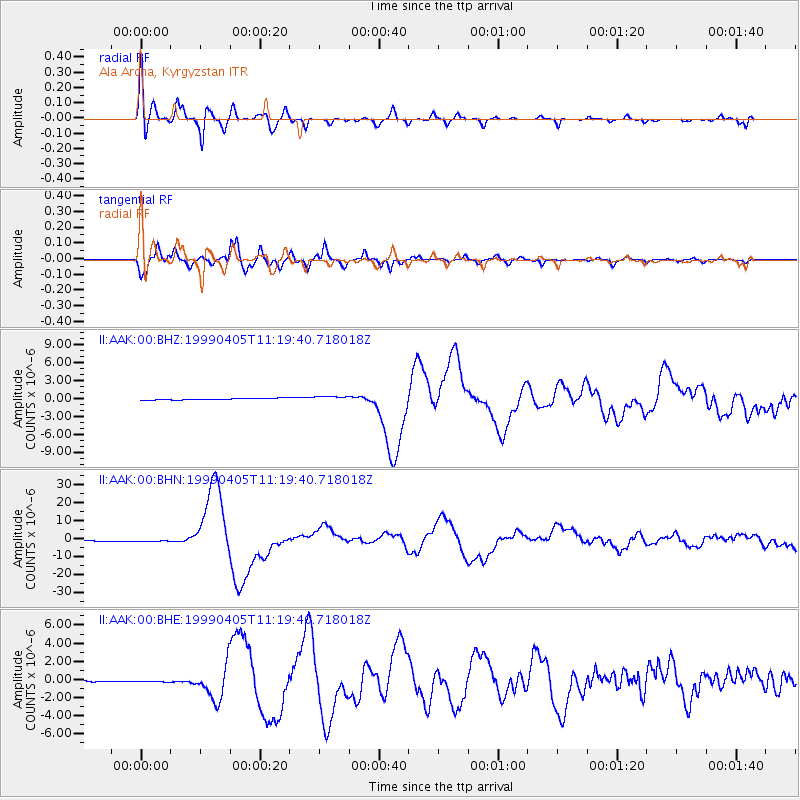
Earthquake location: New Britain Region, P.N.G.
Earthquake latitude/longitude: -5.6/149.6
Earthquake time(UTC): 1999/04/05 (095) 11:08:04 GMT
Earthquake Depth: 150 km
Earthquake Magnitude: 6.2 MB, 7.0 MS, 7.4 MW, 7.3 ME
Earthquake Catalog/Contributor: WHDF/NEIC
Network: II Global Seismograph Network (GSN - IRIS/IDA)
Station: AAK Ala Archa, Kyrgyzstan
Lat/Lon: 42.64 N/74.49 E
Elevation: 1645 m
Distance: 82.9 deg
Az: 314.066 deg
Baz: 104.261 deg
Ray Param: 0.046228237
Estimated Moho Depth: 19.0 km
Estimated Crust Vp/Vs: 1.75
Assumed Crust Vp: 6.306 km/s
Estimated Crust Vs: 3.598 km/s
Estimated Crust Poisson's Ratio: 0.26
Radial Match: 95.19173 %
Radial Bump: 400
Transverse Match: 95.62033 %
Transverse Bump: 400
SOD ConfigId: 4480
Insert Time: 2010-03-01 15:22:53.877 +0000
GWidth: 2.5
Max Bumps: 400
Tol: 0.001

Signal To Noise

ChannelStoNSTALTA
II:AAK:00:BHN:19990405T11:19:40.718018Z2.89861857.614692E-72.6270072E-7
II:AAK:00:BHE:19990405T11:19:40.718018Z2.61464079.87329E-83.7761556E-8
II:AAK:00:BHZ:19990405T11:19:40.718018Z3.33153634.013249E-71.2046242E-7
Arrivals
Ps2.3 SECOND
PpPs8.1 SECOND
PsPs/PpSs10 SECOND