You are here: Home > Network List > IU - Global Seismograph Network (GSN - IRIS/USGS) Stations List
> Station RSSD Black Hills, South Dakota, USA > Earthquake Result Viewer
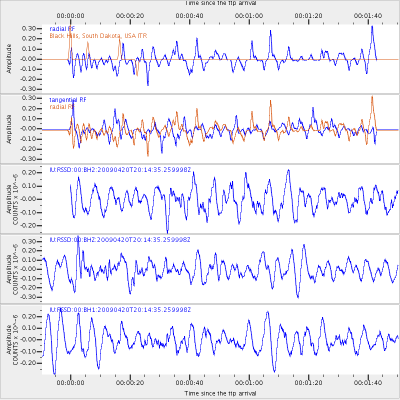
RSSD Black Hills, South Dakota, USA - Earthquake Result Viewer
*The percent match for this event was below the threshold and hence no stack was calculated.
| Earthquake location: |
Tonga Islands |
| Earthquake latitude/longitude: |
-15.2/-173.7 |
| Earthquake time(UTC): |
2009/04/20 (110) 20:02:27 GMT |
| Earthquake Depth: |
35 km |
| Earthquake Magnitude: |
5.6 MW |
| Earthquake Catalog/Contributor: |
NEIC PDE/NEIC PDE-M |
|
| Network: |
IU Global Seismograph Network (GSN - IRIS/USGS) |
| Station: |
RSSD Black Hills, South Dakota, USA |
| Lat/Lon: |
44.12 N/104.04 W |
| Elevation: |
2060 m |
|
| Distance: |
86.5 deg |
| Az: |
42.585 deg |
| Baz: |
245.13 deg |
| Ray Param: |
$rayparam |
*The percent match for this event was below the threshold and hence was not used in the summary stack. |
|
| Radial Match: |
62.876606 % |
| Radial Bump: |
380 |
| Transverse Match: |
47.510365 % |
| Transverse Bump: |
336 |
| SOD ConfigId: |
590571 |
| Insert Time: |
2013-09-27 13:18:45.980 +0000 |
| GWidth: |
2.5 |
| Max Bumps: |
400 |
| Tol: |
0.001 |
|
Signal To Noise
| Channel | StoN | STA | LTA |
| IU:RSSD:00:BHZ:20090420T20:14:35.259998Z | 1.9274212 | 1.652888E-7 | 8.575645E-8 |
| IU:RSSD:00:BH1:20090420T20:14:35.259998Z | 1.2260156 | 1.1369452E-7 | 9.273497E-8 |
| IU:RSSD:00:BH2:20090420T20:14:35.259998Z | 1.4176986 | 1.00967384E-7 | 7.121921E-8 |
| Arrivals |
| Ps | |
| PpPs | |
| PsPs/PpSs | |


