You are here: Home > Network List > IU - Global Seismograph Network (GSN - IRIS/USGS) Stations List
> Station RSSD Black Hills, South Dakota, USA > Earthquake Result Viewer
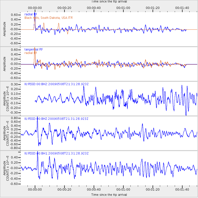
RSSD Black Hills, South Dakota, USA - Earthquake Result Viewer
*The percent match for this event was below the threshold and hence no stack was calculated.
| Earthquake location: |
Kamchatka Peninsula, Russia |
| Earthquake latitude/longitude: |
58.1/164.3 |
| Earthquake time(UTC): |
2009/05/08 (128) 21:22:29 GMT |
| Earthquake Depth: |
8.7 km |
| Earthquake Magnitude: |
5.6 MB |
| Earthquake Catalog/Contributor: |
NEIC PDE/NEIC PDE-M |
|
| Network: |
IU Global Seismograph Network (GSN - IRIS/USGS) |
| Station: |
RSSD Black Hills, South Dakota, USA |
| Lat/Lon: |
44.12 N/104.04 W |
| Elevation: |
2060 m |
|
| Distance: |
54.8 deg |
| Az: |
61.784 deg |
| Baz: |
319.522 deg |
| Ray Param: |
$rayparam |
*The percent match for this event was below the threshold and hence was not used in the summary stack. |
|
| Radial Match: |
71.93698 % |
| Radial Bump: |
400 |
| Transverse Match: |
64.6131 % |
| Transverse Bump: |
400 |
| SOD ConfigId: |
590571 |
| Insert Time: |
2013-09-27 13:46:16.789 +0000 |
| GWidth: |
2.5 |
| Max Bumps: |
400 |
| Tol: |
0.001 |
|
Signal To Noise
| Channel | StoN | STA | LTA |
| IU:RSSD:00:BHZ:20090508T21:31:28.923Z | 5.3891945 | 3.7618076E-7 | 6.980278E-8 |
| IU:RSSD:00:BH1:20090508T21:31:28.923Z | 4.2778535 | 2.3611375E-7 | 5.5194445E-8 |
| IU:RSSD:00:BH2:20090508T21:31:28.923Z | 1.8362947 | 9.130971E-8 | 4.9724974E-8 |
| Arrivals |
| Ps | |
| PpPs | |
| PsPs/PpSs | |


