AAK Ala Archa, Kyrgyzstan - Earthquake Result Viewer
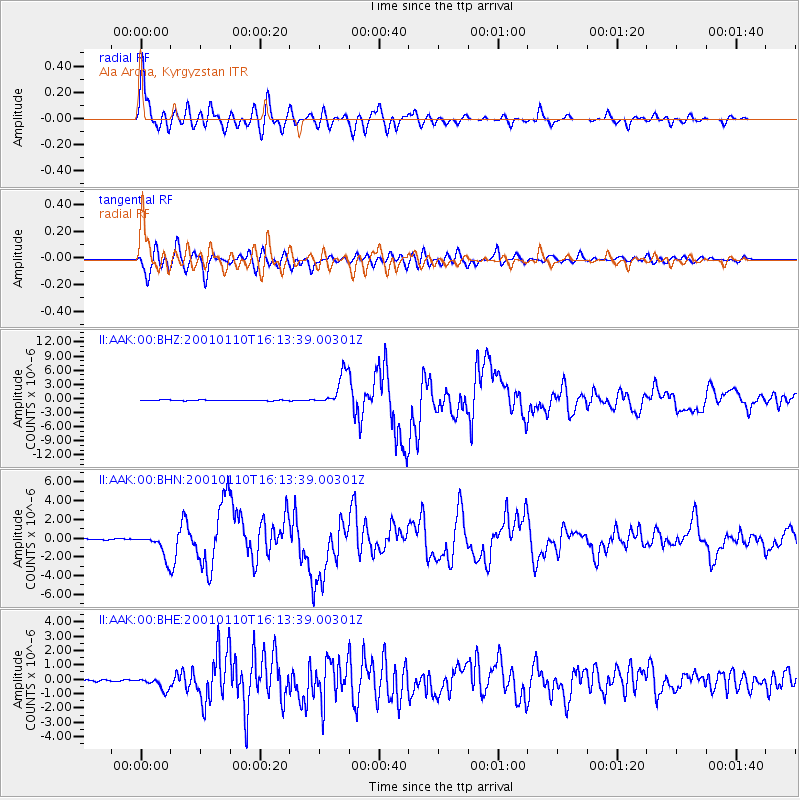
Earthquake location: Kodiak Island Region, Alaska
Earthquake latitude/longitude: 57.1/-153.2
Earthquake time(UTC): 2001/01/10 (010) 16:02:44 GMT
Earthquake Depth: 33 km
Earthquake Magnitude: 6.2 MB, 6.8 MS, 7.1 MW, 6.8 ML
Earthquake Catalog/Contributor: WHDF/NEIC
Network: II Global Seismograph Network (GSN - IRIS/IDA)
Station: AAK Ala Archa, Kyrgyzstan
Lat/Lon: 42.64 N/74.49 E
Elevation: 1645 m
Distance: 72.9 deg
Az: 325.173 deg
Baz: 25.001 deg
Ray Param: 0.053317253
Estimated Moho Depth: 52.25 km
Estimated Crust Vp/Vs: 1.66
Assumed Crust Vp: 6.306 km/s
Estimated Crust Vs: 3.793 km/s
Estimated Crust Poisson's Ratio: 0.22
Radial Match: 97.89284 %
Radial Bump: 400
Transverse Match: 94.601746 %
Transverse Bump: 400
SOD ConfigId: 3744
Insert Time: 2010-03-01 15:23:25.695 +0000
GWidth: 2.5
Max Bumps: 400
Tol: 0.001

Signal To Noise

ChannelStoNSTALTA
II:AAK:00:BHN:20010110T16:13:39.00301Z19.9734781.3010648E-66.513962E-8
II:AAK:00:BHE:20010110T16:13:39.00301Z5.79053454.1478967E-77.1632364E-8
II:AAK:00:BHZ:20010110T16:13:39.00301Z42.983163.4807435E-68.097925E-8
Arrivals
Ps5.7 SECOND
PpPs21 SECOND
PsPs/PpSs27 SECOND