You are here: Home > Network List > IU - Global Seismograph Network (GSN - IRIS/USGS) Stations List
> Station RSSD Black Hills, South Dakota, USA > Earthquake Result Viewer
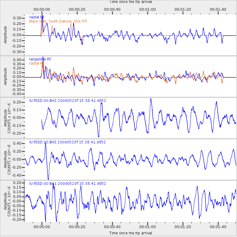
RSSD Black Hills, South Dakota, USA - Earthquake Result Viewer
*The percent match for this event was below the threshold and hence no stack was calculated.
| Earthquake location: |
Southern East Pacific Rise |
| Earthquake latitude/longitude: |
-43.8/-107.2 |
| Earthquake time(UTC): |
2009/05/29 (149) 15:26:25 GMT |
| Earthquake Depth: |
10 km |
| Earthquake Magnitude: |
5.6 MB |
| Earthquake Catalog/Contributor: |
NEIC PDE/NEIC PDE-M |
|
| Network: |
IU Global Seismograph Network (GSN - IRIS/USGS) |
| Station: |
RSSD Black Hills, South Dakota, USA |
| Lat/Lon: |
44.12 N/104.04 W |
| Elevation: |
2060 m |
|
| Distance: |
87.6 deg |
| Az: |
2.269 deg |
| Baz: |
182.281 deg |
| Ray Param: |
$rayparam |
*The percent match for this event was below the threshold and hence was not used in the summary stack. |
|
| Radial Match: |
50.842735 % |
| Radial Bump: |
400 |
| Transverse Match: |
68.94466 % |
| Transverse Bump: |
400 |
| SOD ConfigId: |
590571 |
| Insert Time: |
2013-09-27 14:27:14.183 +0000 |
| GWidth: |
2.5 |
| Max Bumps: |
400 |
| Tol: |
0.001 |
|
Signal To Noise
| Channel | StoN | STA | LTA |
| IU:RSSD:00:BHZ:20090529T15:38:41.985Z | 3.3601282 | 2.2329314E-7 | 6.645376E-8 |
| IU:RSSD:00:BH1:20090529T15:38:41.985Z | 1.1338178 | 7.6464104E-8 | 6.74395E-8 |
| IU:RSSD:00:BH2:20090529T15:38:41.985Z | 1.8837286 | 1.2702115E-7 | 6.7430705E-8 |
| Arrivals |
| Ps | |
| PpPs | |
| PsPs/PpSs | |


