AAK Ala Archa, Kyrgyzstan - Earthquake Result Viewer
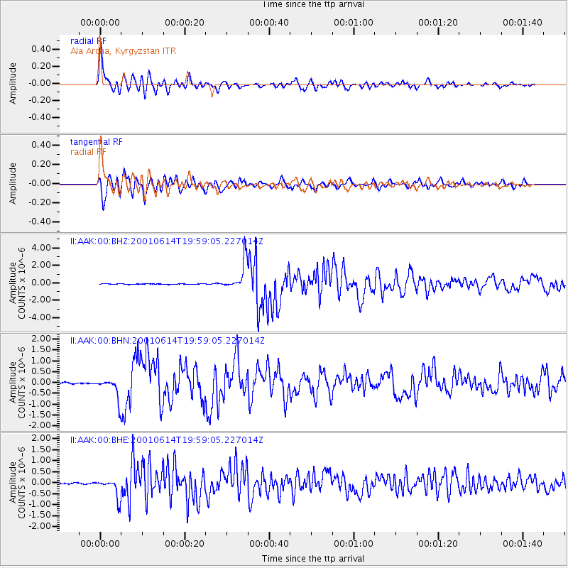
Earthquake location: Andreanof Islands, Aleutian Is.
Earthquake latitude/longitude: 51.2/-179.8
Earthquake time(UTC): 2001/06/14 (165) 19:48:47 GMT
Earthquake Depth: 18 km
Earthquake Magnitude: 6.0 MB, 6.3 MS, 6.5 MW, 6.1 ML
Earthquake Catalog/Contributor: WHDF/NEIC
Network: II Global Seismograph Network (GSN - IRIS/IDA)
Station: AAK Ala Archa, Kyrgyzstan
Lat/Lon: 42.64 N/74.49 E
Elevation: 1645 m
Distance: 66.5 deg
Az: 309.223 deg
Baz: 41.384 deg
Ray Param: 0.057558
Estimated Moho Depth: 52.25 km
Estimated Crust Vp/Vs: 1.65
Assumed Crust Vp: 6.306 km/s
Estimated Crust Vs: 3.81 km/s
Estimated Crust Poisson's Ratio: 0.21
Radial Match: 94.74275 %
Radial Bump: 400
Transverse Match: 92.36736 %
Transverse Bump: 400
SOD ConfigId: 4714
Insert Time: 2010-03-01 15:23:52.311 +0000
GWidth: 2.5
Max Bumps: 400
Tol: 0.001

Signal To Noise

ChannelStoNSTALTA
II:AAK:00:BHN:20010614T19:59:05.227014Z18.9638524.9608315E-72.6159407E-8
II:AAK:00:BHE:20010614T19:59:05.227014Z20.9537124.5352763E-72.1644261E-8
II:AAK:00:BHZ:20010614T19:59:05.227014Z56.2359351.7067238E-63.0349344E-8
Arrivals
Ps5.7 SECOND
PpPs21 SECOND
PsPs/PpSs27 SECOND