AAK Ala Archa, Kyrgyzstan - Earthquake Result Viewer
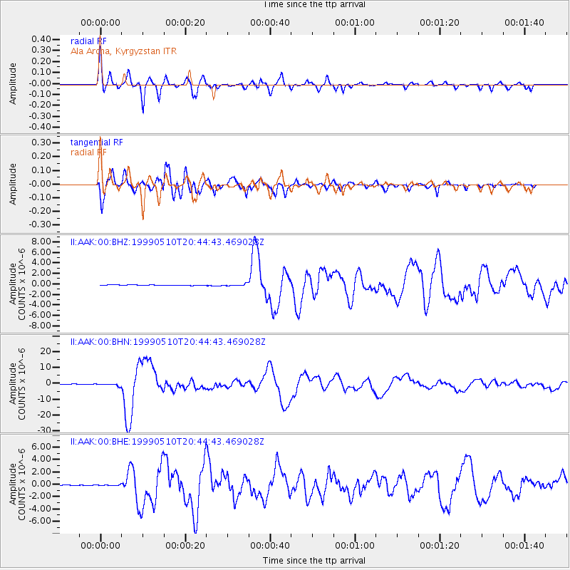
Earthquake location: New Britain Region, P.N.G.
Earthquake latitude/longitude: -5.2/150.9
Earthquake time(UTC): 1999/05/10 (130) 20:33:02 GMT
Earthquake Depth: 138 km
Earthquake Magnitude: 6.5 MB, 6.8 MS, 7.1 MW, 6.5 MB
Earthquake Catalog/Contributor: WHDF/NEIC
Network: II Global Seismograph Network (GSN - IRIS/IDA)
Station: AAK Ala Archa, Kyrgyzstan
Lat/Lon: 42.64 N/74.49 E
Elevation: 1645 m
Distance: 83.5 deg
Az: 313.8 deg
Baz: 103.037 deg
Ray Param: 0.04580593
Estimated Moho Depth: 58.0 km
Estimated Crust Vp/Vs: 1.71
Assumed Crust Vp: 6.306 km/s
Estimated Crust Vs: 3.699 km/s
Estimated Crust Poisson's Ratio: 0.24
Radial Match: 95.10202 %
Radial Bump: 400
Transverse Match: 96.30506 %
Transverse Bump: 400
SOD ConfigId: 4480
Insert Time: 2010-03-01 15:24:18.568 +0000
GWidth: 2.5
Max Bumps: 400
Tol: 0.001

Signal To Noise

ChannelStoNSTALTA
II:AAK:00:BHN:19990510T20:44:43.469028Z5.8188287.460502E-71.2821314E-7
II:AAK:00:BHE:19990510T20:44:43.469028Z2.2460436.047204E-82.6923813E-8
II:AAK:00:BHZ:19990510T20:44:43.469028Z3.41713022.0119698E-75.8878932E-8
Arrivals
Ps6.6 SECOND
PpPs24 SECOND
PsPs/PpSs31 SECOND