You are here: Home > Network List > IU - Global Seismograph Network (GSN - IRIS/USGS) Stations List
> Station RSSD Black Hills, South Dakota, USA > Earthquake Result Viewer
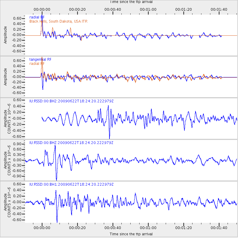
RSSD Black Hills, South Dakota, USA - Earthquake Result Viewer
*The percent match for this event was below the threshold and hence no stack was calculated.
| Earthquake location: |
Svalbard Region |
| Earthquake latitude/longitude: |
76.2/6.8 |
| Earthquake time(UTC): |
2009/06/22 (173) 18:15:39 GMT |
| Earthquake Depth: |
10 km |
| Earthquake Magnitude: |
5.5 MB |
| Earthquake Catalog/Contributor: |
NEIC PDE/NEIC PDE-M |
|
| Network: |
IU Global Seismograph Network (GSN - IRIS/USGS) |
| Station: |
RSSD Black Hills, South Dakota, USA |
| Lat/Lon: |
44.12 N/104.04 W |
| Elevation: |
2060 m |
|
| Distance: |
52.3 deg |
| Az: |
301.642 deg |
| Baz: |
16.456 deg |
| Ray Param: |
$rayparam |
*The percent match for this event was below the threshold and hence was not used in the summary stack. |
|
| Radial Match: |
73.59437 % |
| Radial Bump: |
400 |
| Transverse Match: |
69.28889 % |
| Transverse Bump: |
400 |
| SOD ConfigId: |
590571 |
| Insert Time: |
2013-09-27 15:20:03.798 +0000 |
| GWidth: |
2.5 |
| Max Bumps: |
400 |
| Tol: |
0.001 |
|
Signal To Noise
| Channel | StoN | STA | LTA |
| IU:RSSD:00:BHZ:20090622T18:24:20.222979Z | 3.781312 | 2.78591E-7 | 7.367574E-8 |
| IU:RSSD:00:BH1:20090622T18:24:20.222979Z | 1.5591137 | 9.08129E-8 | 5.824649E-8 |
| IU:RSSD:00:BH2:20090622T18:24:20.222979Z | 1.1924473 | 1.313523E-7 | 1.10153536E-7 |
| Arrivals |
| Ps | |
| PpPs | |
| PsPs/PpSs | |


