You are here: Home > Network List > IU - Global Seismograph Network (GSN - IRIS/USGS) Stations List
> Station RSSD Black Hills, South Dakota, USA > Earthquake Result Viewer
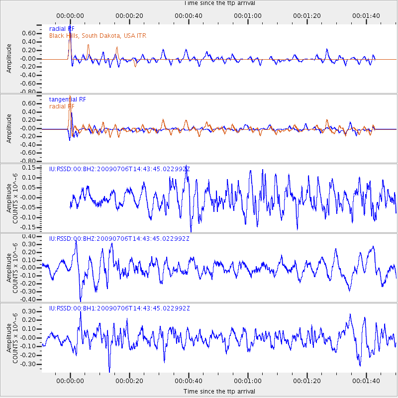
RSSD Black Hills, South Dakota, USA - Earthquake Result Viewer
*The percent match for this event was below the threshold and hence no stack was calculated.
| Earthquake location: |
Near Coast Of Nicaragua |
| Earthquake latitude/longitude: |
11.4/-86.5 |
| Earthquake time(UTC): |
2009/07/06 (187) 14:37:22 GMT |
| Earthquake Depth: |
76 km |
| Earthquake Magnitude: |
5.5 MW |
| Earthquake Catalog/Contributor: |
NEIC PDE/NEIC PDE-M |
|
| Network: |
IU Global Seismograph Network (GSN - IRIS/USGS) |
| Station: |
RSSD Black Hills, South Dakota, USA |
| Lat/Lon: |
44.12 N/104.04 W |
| Elevation: |
2060 m |
|
| Distance: |
36.0 deg |
| Az: |
338.307 deg |
| Baz: |
149.784 deg |
| Ray Param: |
$rayparam |
*The percent match for this event was below the threshold and hence was not used in the summary stack. |
|
| Radial Match: |
78.5844 % |
| Radial Bump: |
400 |
| Transverse Match: |
57.67375 % |
| Transverse Bump: |
400 |
| SOD ConfigId: |
590571 |
| Insert Time: |
2013-09-27 15:53:00.726 +0000 |
| GWidth: |
2.5 |
| Max Bumps: |
400 |
| Tol: |
0.001 |
|
Signal To Noise
| Channel | StoN | STA | LTA |
| IU:RSSD:00:BHZ:20090706T14:43:45.022992Z | 4.296182 | 2.0134031E-7 | 4.6864937E-8 |
| IU:RSSD:00:BH1:20090706T14:43:45.022992Z | 2.5791926 | 1.1765306E-7 | 4.5616236E-8 |
| IU:RSSD:00:BH2:20090706T14:43:45.022992Z | 1.6667341 | 5.069316E-8 | 3.0414665E-8 |
| Arrivals |
| Ps | |
| PpPs | |
| PsPs/PpSs | |


