You are here: Home > Network List > IW - Intermountain West Stations List
> Station MOOW Moose Ponds, Wyoming, USA > Earthquake Result Viewer
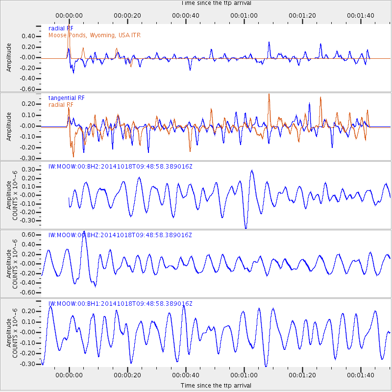
MOOW Moose Ponds, Wyoming, USA - Earthquake Result Viewer
*The percent match for this event was below the threshold and hence no stack was calculated.
| Earthquake location: |
Iceland |
| Earthquake latitude/longitude: |
64.5/-17.6 |
| Earthquake time(UTC): |
2014/10/18 (291) 09:40:12 GMT |
| Earthquake Depth: |
4.7 km |
| Earthquake Magnitude: |
5.3 MW |
| Earthquake Catalog/Contributor: |
ISC/ISC |
|
| Network: |
IW Intermountain West |
| Station: |
MOOW Moose Ponds, Wyoming, USA |
| Lat/Lon: |
43.75 N/110.74 W |
| Elevation: |
2128 m |
|
| Distance: |
52.8 deg |
| Az: |
294.768 deg |
| Baz: |
32.804 deg |
| Ray Param: |
$rayparam |
*The percent match for this event was below the threshold and hence was not used in the summary stack. |
|
| Radial Match: |
45.992928 % |
| Radial Bump: |
400 |
| Transverse Match: |
61.45819 % |
| Transverse Bump: |
350 |
| SOD ConfigId: |
3390531 |
| Insert Time: |
2019-04-14 14:45:09.830 +0000 |
| GWidth: |
2.5 |
| Max Bumps: |
400 |
| Tol: |
0.001 |
|
Signal To Noise
| Channel | StoN | STA | LTA |
| IW:MOOW:00:BHZ:20141018T09:48:58.389016Z | 2.7016244 | 3.1070456E-7 | 1.1500657E-7 |
| IW:MOOW:00:BH1:20141018T09:48:58.389016Z | 0.44571936 | 8.488571E-8 | 1.9044656E-7 |
| IW:MOOW:00:BH2:20141018T09:48:58.389016Z | 0.766298 | 8.679202E-8 | 1.1326145E-7 |
| Arrivals |
| Ps | |
| PpPs | |
| PsPs/PpSs | |


