You are here: Home > Network List > IU - Global Seismograph Network (GSN - IRIS/USGS) Stations List
> Station RSSD Black Hills, South Dakota, USA > Earthquake Result Viewer
RSSD Black Hills, South Dakota, USA - Earthquake Result Viewer
*The percent match for this event was below the threshold and hence no stack was calculated.
| Earthquake location: |
Volcano Islands, Japan Region |
| Earthquake latitude/longitude: |
22.6/143.3 |
| Earthquake time(UTC): |
2009/07/29 (210) 14:52:08 GMT |
| Earthquake Depth: |
140 km |
| Earthquake Magnitude: |
5.5 MW, 5.2 MB, 5.4 MW |
| Earthquake Catalog/Contributor: |
WHDF/NEIC |
|
| Network: |
IU Global Seismograph Network (GSN - IRIS/USGS) |
| Station: |
RSSD Black Hills, South Dakota, USA |
| Lat/Lon: |
44.12 N/104.04 W |
| Elevation: |
2060 m |
|
| Distance: |
89.5 deg |
| Az: |
41.639 deg |
| Baz: |
301.49 deg |
| Ray Param: |
$rayparam |
*The percent match for this event was below the threshold and hence was not used in the summary stack. |
|
| Radial Match: |
55.96531 % |
| Radial Bump: |
376 |
| Transverse Match: |
65.629906 % |
| Transverse Bump: |
345 |
| SOD ConfigId: |
617450 |
| Insert Time: |
2013-09-30 14:27:56.173 +0000 |
| GWidth: |
2.5 |
| Max Bumps: |
400 |
| Tol: |
0.001 |
|
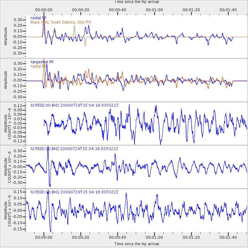
Signal To Noise
| Channel | StoN | STA | LTA |
| IU:RSSD:00:BHZ:20090729T15:04:18.635022Z | 4.353713 | 1.6884164E-7 | 3.8781064E-8 |
| IU:RSSD:00:BH1:20090729T15:04:18.635022Z | 1.8235215 | 8.790176E-8 | 4.8204402E-8 |
| IU:RSSD:00:BH2:20090729T15:04:18.635022Z | 1.383788 | 4.8677926E-8 | 3.51773E-8 |
| Arrivals |
| Ps | |
| PpPs | |
| PsPs/PpSs | |


