You are here: Home > Network List > IU - Global Seismograph Network (GSN - IRIS/USGS) Stations List
> Station RSSD Black Hills, South Dakota, USA > Earthquake Result Viewer
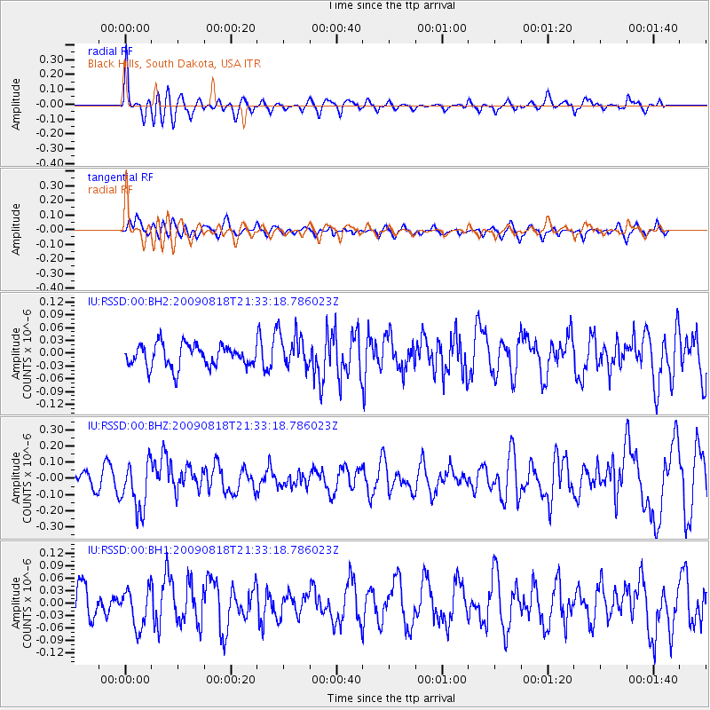
RSSD Black Hills, South Dakota, USA - Earthquake Result Viewer
*The percent match for this event was below the threshold and hence no stack was calculated.
| Earthquake location: |
South Of Fiji Islands |
| Earthquake latitude/longitude: |
-26.1/-178.4 |
| Earthquake time(UTC): |
2009/08/18 (230) 21:20:47 GMT |
| Earthquake Depth: |
270 km |
| Earthquake Magnitude: |
5.5 MB, 6.3 MW, 6.3 MW |
| Earthquake Catalog/Contributor: |
WHDF/NEIC |
|
| Network: |
IU Global Seismograph Network (GSN - IRIS/USGS) |
| Station: |
RSSD Black Hills, South Dakota, USA |
| Lat/Lon: |
44.12 N/104.04 W |
| Elevation: |
2060 m |
|
| Distance: |
97.4 deg |
| Az: |
44.373 deg |
| Baz: |
240.853 deg |
| Ray Param: |
$rayparam |
*The percent match for this event was below the threshold and hence was not used in the summary stack. |
|
| Radial Match: |
66.74458 % |
| Radial Bump: |
400 |
| Transverse Match: |
48.024986 % |
| Transverse Bump: |
373 |
| SOD ConfigId: |
617450 |
| Insert Time: |
2013-09-30 15:05:55.638 +0000 |
| GWidth: |
2.5 |
| Max Bumps: |
400 |
| Tol: |
0.001 |
|
Signal To Noise
| Channel | StoN | STA | LTA |
| IU:RSSD:00:BHZ:20090818T21:33:18.786023Z | 2.729081 | 1.5361024E-7 | 5.628644E-8 |
| IU:RSSD:00:BH1:20090818T21:33:18.786023Z | 1.1282525 | 4.705751E-8 | 4.1708315E-8 |
| IU:RSSD:00:BH2:20090818T21:33:18.786023Z | 1.5478247 | 4.0040796E-8 | 2.5869076E-8 |
| Arrivals |
| Ps | |
| PpPs | |
| PsPs/PpSs | |


