You are here: Home > Network List > UW - Pacific Northwest Regional Seismic Network Stations List
> Station UMAT Pilot Rock, OR, USA > Earthquake Result Viewer
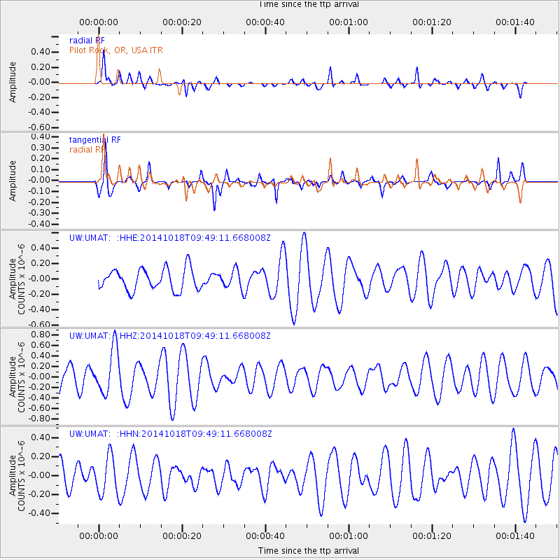
UMAT Pilot Rock, OR, USA - Earthquake Result Viewer
*The percent match for this event was below the threshold and hence no stack was calculated.
| Earthquake location: |
Iceland |
| Earthquake latitude/longitude: |
64.5/-17.6 |
| Earthquake time(UTC): |
2014/10/18 (291) 09:40:12 GMT |
| Earthquake Depth: |
4.7 km |
| Earthquake Magnitude: |
5.3 MW |
| Earthquake Catalog/Contributor: |
ISC/ISC |
|
| Network: |
UW Pacific Northwest Regional Seismic Network |
| Station: |
UMAT Pilot Rock, OR, USA |
| Lat/Lon: |
45.29 N/118.96 W |
| Elevation: |
1318 m |
|
| Distance: |
54.7 deg |
| Az: |
301.955 deg |
| Baz: |
31.313 deg |
| Ray Param: |
$rayparam |
*The percent match for this event was below the threshold and hence was not used in the summary stack. |
|
| Radial Match: |
56.315723 % |
| Radial Bump: |
367 |
| Transverse Match: |
70.52041 % |
| Transverse Bump: |
316 |
| SOD ConfigId: |
3390531 |
| Insert Time: |
2019-04-14 14:50:32.162 +0000 |
| GWidth: |
2.5 |
| Max Bumps: |
400 |
| Tol: |
0.001 |
|
Signal To Noise
| Channel | StoN | STA | LTA |
| UW:UMAT: :HHZ:20141018T09:49:11.668008Z | 1.8850968 | 4.3958536E-7 | 2.3318982E-7 |
| UW:UMAT: :HHN:20141018T09:49:11.668008Z | 1.1745298 | 2.0280277E-7 | 1.7266721E-7 |
| UW:UMAT: :HHE:20141018T09:49:11.668008Z | 0.85852265 | 1.197033E-7 | 1.394294E-7 |
| Arrivals |
| Ps | |
| PpPs | |
| PsPs/PpSs | |


