AAK Ala Archa, Kyrgyzstan - Earthquake Result Viewer
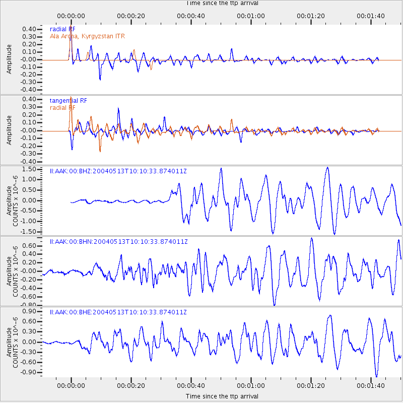
Earthquake location: New Ireland Region, P.N.G.
Earthquake latitude/longitude: -3.6/150.7
Earthquake time(UTC): 2004/05/13 (134) 09:58:43 GMT
Earthquake Depth: 10 km
Earthquake Magnitude: 5.8 MB, 6.3 MS, 6.3 MW, 6.2 MW
Earthquake Catalog/Contributor: WHDF/NEIC
Network: II Global Seismograph Network (GSN - IRIS/IDA)
Station: AAK Ala Archa, Kyrgyzstan
Lat/Lon: 42.64 N/74.49 E
Elevation: 1645 m
Distance: 82.3 deg
Az: 313.684 deg
Baz: 102.002 deg
Ray Param: 0.04695606
Estimated Moho Depth: 58.25 km
Estimated Crust Vp/Vs: 1.72
Assumed Crust Vp: 6.306 km/s
Estimated Crust Vs: 3.672 km/s
Estimated Crust Poisson's Ratio: 0.24
Radial Match: 95.992676 %
Radial Bump: 367
Transverse Match: 94.78632 %
Transverse Bump: 400
SOD ConfigId: 2459
Insert Time: 2010-03-01 15:26:11.778 +0000
GWidth: 2.5
Max Bumps: 400
Tol: 0.001

Signal To Noise

ChannelStoNSTALTA
II:AAK:00:BHN:20040513T10:10:33.874011Z1.13551124.234557E-83.729208E-8
II:AAK:00:BHE:20040513T10:10:33.874011Z3.99543368.5495294E-82.1398252E-8
II:AAK:00:BHZ:20040513T10:10:33.874011Z5.01905352.3659155E-74.7138677E-8
Arrivals
Ps6.8 SECOND
PpPs24 SECOND
PsPs/PpSs31 SECOND