You are here: Home > Network List > AK - Alaska Regional Network Stations List
> Station CUT Chulitna, AK, USA > Earthquake Result Viewer
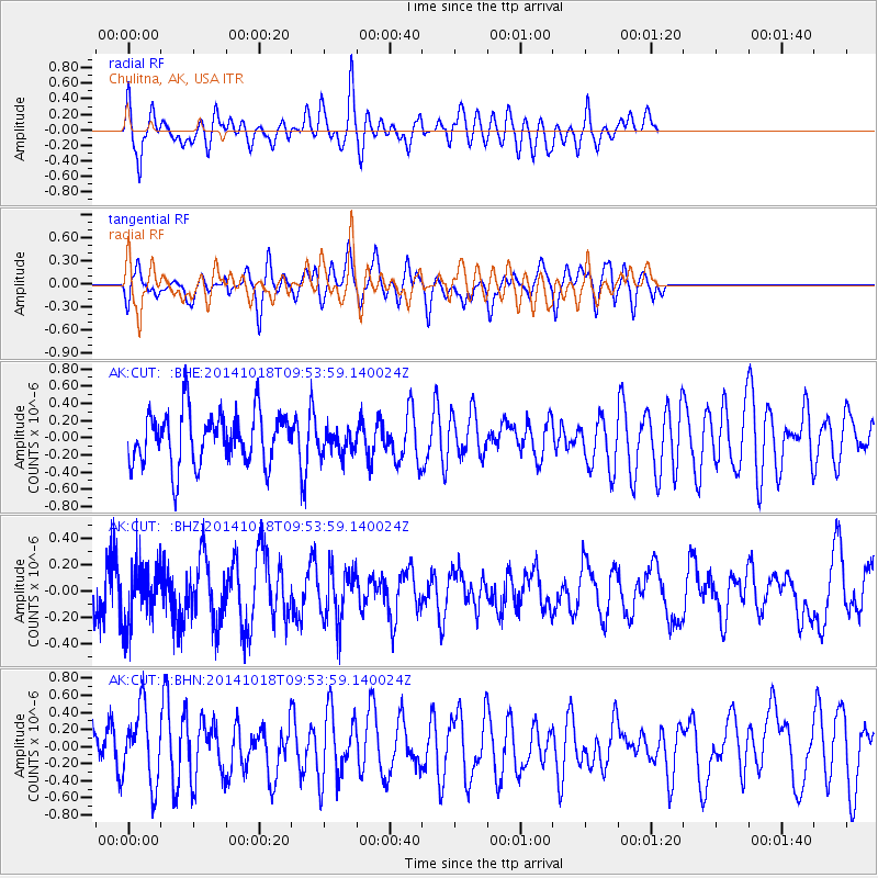
CUT Chulitna, AK, USA - Earthquake Result Viewer
*The percent match for this event was below the threshold and hence no stack was calculated.
| Earthquake location: |
South Of Kermadec Islands |
| Earthquake latitude/longitude: |
-33.2/-179.1 |
| Earthquake time(UTC): |
2014/10/18 (291) 09:40:58 GMT |
| Earthquake Depth: |
45 km |
| Earthquake Magnitude: |
5.0 mb |
| Earthquake Catalog/Contributor: |
ISC/ISC |
|
| Network: |
AK Alaska Regional Network |
| Station: |
CUT Chulitna, AK, USA |
| Lat/Lon: |
62.41 N/150.26 W |
| Elevation: |
574 m |
|
| Distance: |
98.1 deg |
| Az: |
13.094 deg |
| Baz: |
204.074 deg |
| Ray Param: |
$rayparam |
*The percent match for this event was below the threshold and hence was not used in the summary stack. |
|
| Radial Match: |
50.667355 % |
| Radial Bump: |
400 |
| Transverse Match: |
58.98193 % |
| Transverse Bump: |
400 |
| SOD ConfigId: |
3390531 |
| Insert Time: |
2019-04-14 14:55:08.730 +0000 |
| GWidth: |
2.5 |
| Max Bumps: |
400 |
| Tol: |
0.001 |
|
Signal To Noise
| Channel | StoN | STA | LTA |
| AK:CUT: :BHZ:20141018T09:53:59.140024Z | 1.1064095 | 2.2035887E-7 | 1.9916573E-7 |
| AK:CUT: :BHN:20141018T09:53:59.140024Z | 1.4715459 | 4.3693936E-7 | 2.969254E-7 |
| AK:CUT: :BHE:20141018T09:53:59.140024Z | 0.47048083 | 1.4288568E-7 | 3.037014E-7 |
| Arrivals |
| Ps | |
| PpPs | |
| PsPs/PpSs | |


