You are here: Home > Network List > TA - USArray Transportable Network (new EarthScope stations) Stations List
> Station R11A Troy Canyon, Currant, NV, USA > Earthquake Result Viewer
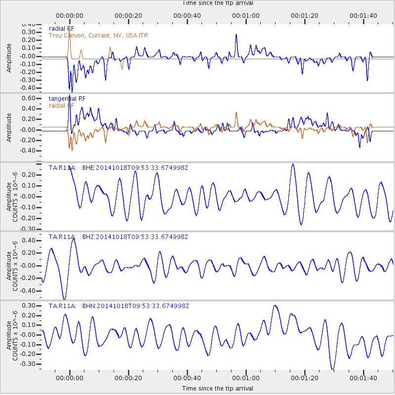
R11A Troy Canyon, Currant, NV, USA - Earthquake Result Viewer
*The percent match for this event was below the threshold and hence no stack was calculated.
| Earthquake location: |
South Of Kermadec Islands |
| Earthquake latitude/longitude: |
-33.2/-179.1 |
| Earthquake time(UTC): |
2014/10/18 (291) 09:40:58 GMT |
| Earthquake Depth: |
45 km |
| Earthquake Magnitude: |
5.0 mb |
| Earthquake Catalog/Contributor: |
ISC/ISC |
|
| Network: |
TA USArray Transportable Network (new EarthScope stations) |
| Station: |
R11A Troy Canyon, Currant, NV, USA |
| Lat/Lon: |
38.35 N/115.59 W |
| Elevation: |
1756 m |
|
| Distance: |
92.4 deg |
| Az: |
44.76 deg |
| Baz: |
228.665 deg |
| Ray Param: |
$rayparam |
*The percent match for this event was below the threshold and hence was not used in the summary stack. |
|
| Radial Match: |
58.617622 % |
| Radial Bump: |
400 |
| Transverse Match: |
49.107822 % |
| Transverse Bump: |
400 |
| SOD ConfigId: |
3390531 |
| Insert Time: |
2019-04-14 14:57:46.178 +0000 |
| GWidth: |
2.5 |
| Max Bumps: |
400 |
| Tol: |
0.001 |
|
Signal To Noise
| Channel | StoN | STA | LTA |
| TA:R11A: :BHZ:20141018T09:53:33.674998Z | 1.4394833 | 2.4286263E-7 | 1.6871513E-7 |
| TA:R11A: :BHN:20141018T09:53:33.674998Z | 0.8044595 | 1.4116785E-7 | 1.754816E-7 |
| TA:R11A: :BHE:20141018T09:53:33.674998Z | 1.1877341 | 1.440635E-7 | 1.2129271E-7 |
| Arrivals |
| Ps | |
| PpPs | |
| PsPs/PpSs | |


