You are here: Home > Network List > IU - Global Seismograph Network (GSN - IRIS/USGS) Stations List
> Station RSSD Black Hills, South Dakota, USA > Earthquake Result Viewer
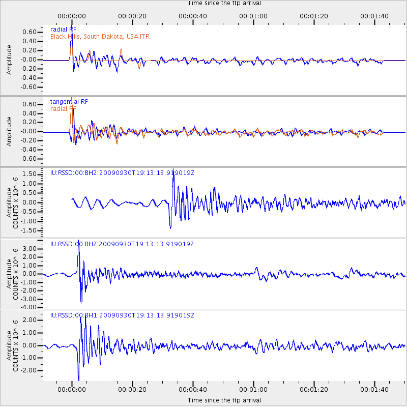
RSSD Black Hills, South Dakota, USA - Earthquake Result Viewer
*The percent match for this event was below the threshold and hence no stack was calculated.
| Earthquake location: |
Peru-Bolivia Border Region |
| Earthquake latitude/longitude: |
-15.6/-69.3 |
| Earthquake time(UTC): |
2009/09/30 (273) 19:03:17 GMT |
| Earthquake Depth: |
255 km |
| Earthquake Magnitude: |
5.9 MB, 5.8 MW |
| Earthquake Catalog/Contributor: |
WHDF/NEIC |
|
| Network: |
IU Global Seismograph Network (GSN - IRIS/USGS) |
| Station: |
RSSD Black Hills, South Dakota, USA |
| Lat/Lon: |
44.12 N/104.04 W |
| Elevation: |
2090 m |
|
| Distance: |
67.3 deg |
| Az: |
333.587 deg |
| Baz: |
143.464 deg |
| Ray Param: |
$rayparam |
*The percent match for this event was below the threshold and hence was not used in the summary stack. |
|
| Radial Match: |
87.59793 % |
| Radial Bump: |
400 |
| Transverse Match: |
81.87361 % |
| Transverse Bump: |
400 |
| SOD ConfigId: |
617450 |
| Insert Time: |
2013-09-30 16:36:16.726 +0000 |
| GWidth: |
2.5 |
| Max Bumps: |
400 |
| Tol: |
0.001 |
|
Signal To Noise
| Channel | StoN | STA | LTA |
| IU:RSSD:00:BHZ:20090930T19:13:13.919019Z | 19.287598 | 1.5157754E-6 | 7.858809E-8 |
| IU:RSSD:00:BH1:20090930T19:13:13.919019Z | 13.391169 | 1.1597738E-6 | 8.6607365E-8 |
| IU:RSSD:00:BH2:20090930T19:13:13.919019Z | 4.2979617 | 6.220567E-7 | 1.4473295E-7 |
| Arrivals |
| Ps | |
| PpPs | |
| PsPs/PpSs | |


