You are here: Home > Network List > TA - USArray Transportable Network (new EarthScope stations) Stations List
> Station R11A Troy Canyon, Currant, NV, USA > Earthquake Result Viewer
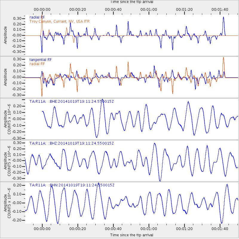
R11A Troy Canyon, Currant, NV, USA - Earthquake Result Viewer
*The percent match for this event was below the threshold and hence no stack was calculated.
| Earthquake location: |
New Ireland Region, P.N.G. |
| Earthquake latitude/longitude: |
-3.5/150.9 |
| Earthquake time(UTC): |
2014/10/19 (292) 18:58:37 GMT |
| Earthquake Depth: |
35 km |
| Earthquake Magnitude: |
5.3 MW |
| Earthquake Catalog/Contributor: |
ISC/ISC |
|
| Network: |
TA USArray Transportable Network (new EarthScope stations) |
| Station: |
R11A Troy Canyon, Currant, NV, USA |
| Lat/Lon: |
38.35 N/115.59 W |
| Elevation: |
1756 m |
|
| Distance: |
94.9 deg |
| Az: |
51.966 deg |
| Baz: |
269.485 deg |
| Ray Param: |
$rayparam |
*The percent match for this event was below the threshold and hence was not used in the summary stack. |
|
| Radial Match: |
45.355736 % |
| Radial Bump: |
296 |
| Transverse Match: |
22.386423 % |
| Transverse Bump: |
271 |
| SOD ConfigId: |
3390531 |
| Insert Time: |
2019-04-14 15:13:36.903 +0000 |
| GWidth: |
2.5 |
| Max Bumps: |
400 |
| Tol: |
0.001 |
|
Signal To Noise
| Channel | StoN | STA | LTA |
| TA:R11A: :BHZ:20141019T19:11:24.550015Z | 0.7927645 | 8.158633E-8 | 1.0291371E-7 |
| TA:R11A: :BHN:20141019T19:11:24.550015Z | 1.5471463 | 1.2219165E-7 | 7.897873E-8 |
| TA:R11A: :BHE:20141019T19:11:24.550015Z | 2.5887947 | 2.1455263E-7 | 8.287742E-8 |
| Arrivals |
| Ps | |
| PpPs | |
| PsPs/PpSs | |


