You are here: Home > Network List > IU - Global Seismograph Network (GSN - IRIS/USGS) Stations List
> Station RSSD Black Hills, South Dakota, USA > Earthquake Result Viewer
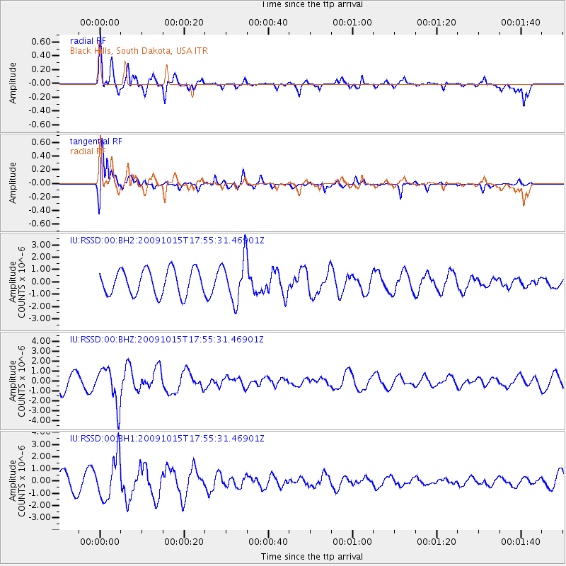
RSSD Black Hills, South Dakota, USA - Earthquake Result Viewer
*The percent match for this event was below the threshold and hence no stack was calculated.
| Earthquake location: |
Galapagos Triple Junction Region |
| Earthquake latitude/longitude: |
3.3/-103.8 |
| Earthquake time(UTC): |
2009/10/15 (288) 17:48:21 GMT |
| Earthquake Depth: |
10 km |
| Earthquake Magnitude: |
5.9 MB, 5.7 MS, 6.0 MW, 6.0 MW |
| Earthquake Catalog/Contributor: |
WHDF/NEIC |
|
| Network: |
IU Global Seismograph Network (GSN - IRIS/USGS) |
| Station: |
RSSD Black Hills, South Dakota, USA |
| Lat/Lon: |
44.12 N/104.04 W |
| Elevation: |
2090 m |
|
| Distance: |
40.7 deg |
| Az: |
359.765 deg |
| Baz: |
179.674 deg |
| Ray Param: |
$rayparam |
*The percent match for this event was below the threshold and hence was not used in the summary stack. |
|
| Radial Match: |
81.00056 % |
| Radial Bump: |
395 |
| Transverse Match: |
75.0731 % |
| Transverse Bump: |
353 |
| SOD ConfigId: |
617450 |
| Insert Time: |
2013-09-30 18:03:14.684 +0000 |
| GWidth: |
2.5 |
| Max Bumps: |
400 |
| Tol: |
0.001 |
|
Signal To Noise
| Channel | StoN | STA | LTA |
| IU:RSSD:00:BHZ:20091015T17:55:31.46901Z | 2.0404358 | 1.8971741E-6 | 9.2978877E-7 |
| IU:RSSD:00:BH1:20091015T17:55:31.46901Z | 2.080601 | 1.7513455E-6 | 8.4174985E-7 |
| IU:RSSD:00:BH2:20091015T17:55:31.46901Z | 1.7548974 | 1.7657486E-6 | 1.0061834E-6 |
| Arrivals |
| Ps | |
| PpPs | |
| PsPs/PpSs | |


