You are here: Home > Network List > IU - Global Seismograph Network (GSN - IRIS/USGS) Stations List
> Station RSSD Black Hills, South Dakota, USA > Earthquake Result Viewer
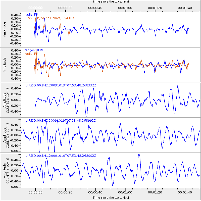
RSSD Black Hills, South Dakota, USA - Earthquake Result Viewer
*The percent match for this event was below the threshold and hence no stack was calculated.
| Earthquake location: |
Samoa Islands Region |
| Earthquake latitude/longitude: |
-15.4/-173.0 |
| Earthquake time(UTC): |
2009/10/19 (292) 07:41:38 GMT |
| Earthquake Depth: |
10 km |
| Earthquake Magnitude: |
5.8 MW, 5.4 MS, 5.4 MB, 5.8 MW |
| Earthquake Catalog/Contributor: |
WHDF/NEIC |
|
| Network: |
IU Global Seismograph Network (GSN - IRIS/USGS) |
| Station: |
RSSD Black Hills, South Dakota, USA |
| Lat/Lon: |
44.12 N/104.04 W |
| Elevation: |
2090 m |
|
| Distance: |
86.2 deg |
| Az: |
42.343 deg |
| Baz: |
244.414 deg |
| Ray Param: |
$rayparam |
*The percent match for this event was below the threshold and hence was not used in the summary stack. |
|
| Radial Match: |
70.49015 % |
| Radial Bump: |
400 |
| Transverse Match: |
51.83103 % |
| Transverse Bump: |
366 |
| SOD ConfigId: |
617450 |
| Insert Time: |
2013-09-30 18:16:44.826 +0000 |
| GWidth: |
2.5 |
| Max Bumps: |
400 |
| Tol: |
0.001 |
|
Signal To Noise
| Channel | StoN | STA | LTA |
| IU:RSSD:00:BHZ:20091019T07:53:48.268992Z | 1.5923997 | 2.812994E-7 | 1.7665126E-7 |
| IU:RSSD:00:BH1:20091019T07:53:48.268992Z | 0.6543937 | 1.2759952E-7 | 1.9498893E-7 |
| IU:RSSD:00:BH2:20091019T07:53:48.268992Z | 3.517475 | 3.373287E-7 | 9.590081E-8 |
| Arrivals |
| Ps | |
| PpPs | |
| PsPs/PpSs | |


