You are here: Home > Network List > GS - US Geological Survey Networks Stations List
> Station KAN13 Rinehart Farm > Earthquake Result Viewer
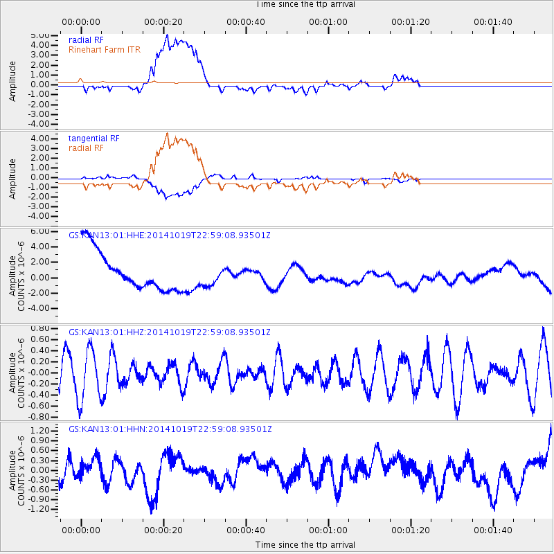
KAN13 Rinehart Farm - Earthquake Result Viewer
*The percent match for this event was below the threshold and hence no stack was calculated.
| Earthquake location: |
North Of Ascension Island |
| Earthquake latitude/longitude: |
-1.1/-12.5 |
| Earthquake time(UTC): |
2014/10/19 (292) 22:46:56 GMT |
| Earthquake Depth: |
10 km |
| Earthquake Magnitude: |
4.9 MW |
| Earthquake Catalog/Contributor: |
ISC/ISC |
|
| Network: |
GS US Geological Survey Networks |
| Station: |
KAN13 Rinehart Farm |
| Lat/Lon: |
37.01 N/97.48 W |
| Elevation: |
340 m |
|
| Distance: |
86.6 deg |
| Az: |
306.988 deg |
| Baz: |
93.855 deg |
| Ray Param: |
$rayparam |
*The percent match for this event was below the threshold and hence was not used in the summary stack. |
|
| Radial Match: |
36.05861 % |
| Radial Bump: |
400 |
| Transverse Match: |
38.84475 % |
| Transverse Bump: |
400 |
| SOD ConfigId: |
3390531 |
| Insert Time: |
2019-04-14 15:25:32.658 +0000 |
| GWidth: |
2.5 |
| Max Bumps: |
400 |
| Tol: |
0.001 |
|
Signal To Noise
| Channel | StoN | STA | LTA |
| GS:KAN13:01:HHZ:20141019T22:59:08.93501Z | 1.5318639 | 4.6099842E-7 | 3.0093952E-7 |
| GS:KAN13:01:HHN:20141019T22:59:08.93501Z | 0.34309876 | 2.5980242E-7 | 7.5722346E-7 |
| GS:KAN13:01:HHE:20141019T22:59:08.93501Z | 0.54047793 | 1.3524561E-6 | 2.5023337E-6 |
| Arrivals |
| Ps | |
| PpPs | |
| PsPs/PpSs | |


