You are here: Home > Network List > IW - Intermountain West Stations List
> Station MOOW Moose Ponds, Wyoming, USA > Earthquake Result Viewer
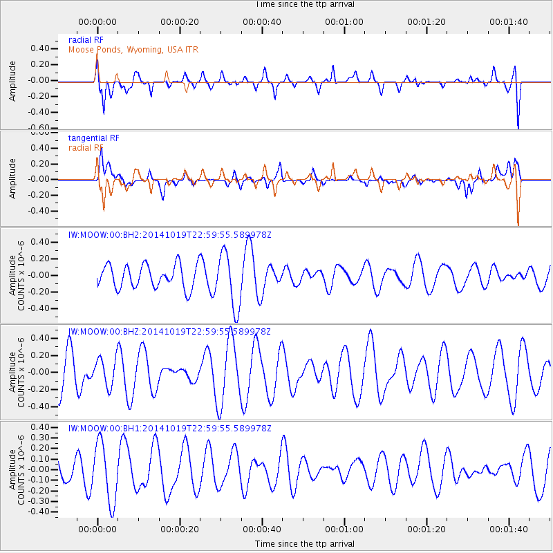
MOOW Moose Ponds, Wyoming, USA - Earthquake Result Viewer
*The percent match for this event was below the threshold and hence no stack was calculated.
| Earthquake location: |
North Of Ascension Island |
| Earthquake latitude/longitude: |
-1.1/-12.5 |
| Earthquake time(UTC): |
2014/10/19 (292) 22:46:56 GMT |
| Earthquake Depth: |
10 km |
| Earthquake Magnitude: |
4.9 MW |
| Earthquake Catalog/Contributor: |
ISC/ISC |
|
| Network: |
IW Intermountain West |
| Station: |
MOOW Moose Ponds, Wyoming, USA |
| Lat/Lon: |
43.75 N/110.74 W |
| Elevation: |
2128 m |
|
| Distance: |
96.7 deg |
| Az: |
313.77 deg |
| Baz: |
85.055 deg |
| Ray Param: |
$rayparam |
*The percent match for this event was below the threshold and hence was not used in the summary stack. |
|
| Radial Match: |
60.840767 % |
| Radial Bump: |
400 |
| Transverse Match: |
56.045353 % |
| Transverse Bump: |
400 |
| SOD ConfigId: |
3390531 |
| Insert Time: |
2019-04-14 15:25:50.473 +0000 |
| GWidth: |
2.5 |
| Max Bumps: |
400 |
| Tol: |
0.001 |
|
Signal To Noise
| Channel | StoN | STA | LTA |
| IW:MOOW:00:BHZ:20141019T22:59:55.589978Z | 0.87516874 | 1.6716052E-7 | 1.9100376E-7 |
| IW:MOOW:00:BH1:20141019T22:59:55.589978Z | 3.0991247 | 2.8683823E-7 | 9.255459E-8 |
| IW:MOOW:00:BH2:20141019T22:59:55.589978Z | 2.4588685 | 3.421505E-7 | 1.3914958E-7 |
| Arrivals |
| Ps | |
| PpPs | |
| PsPs/PpSs | |


