You are here: Home > Network List > TA - USArray Transportable Network (new EarthScope stations) Stations List
> Station O48A Farmland, IN, USA > Earthquake Result Viewer
O48A Farmland, IN, USA - Earthquake Result Viewer
*The percent match for this event was below the threshold and hence no stack was calculated.
| Earthquake location: |
North Of Ascension Island |
| Earthquake latitude/longitude: |
-1.1/-12.5 |
| Earthquake time(UTC): |
2014/10/19 (292) 22:46:56 GMT |
| Earthquake Depth: |
10 km |
| Earthquake Magnitude: |
4.9 MW |
| Earthquake Catalog/Contributor: |
ISC/ISC |
|
| Network: |
TA USArray Transportable Network (new EarthScope stations) |
| Station: |
O48A Farmland, IN, USA |
| Lat/Lon: |
40.26 N/85.16 W |
| Elevation: |
300 m |
|
| Distance: |
77.5 deg |
| Az: |
311.564 deg |
| Baz: |
102.17 deg |
| Ray Param: |
$rayparam |
*The percent match for this event was below the threshold and hence was not used in the summary stack. |
|
| Radial Match: |
62.355186 % |
| Radial Bump: |
400 |
| Transverse Match: |
51.434383 % |
| Transverse Bump: |
326 |
| SOD ConfigId: |
3390531 |
| Insert Time: |
2019-04-14 15:28:25.973 +0000 |
| GWidth: |
2.5 |
| Max Bumps: |
400 |
| Tol: |
0.001 |
|
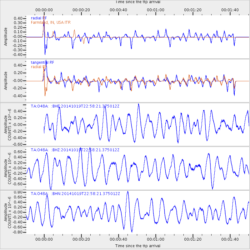
Signal To Noise
| Channel | StoN | STA | LTA |
| TA:O48A: :BHZ:20141019T22:58:21.375012Z | 2.0503173 | 4.4440534E-7 | 2.1674956E-7 |
| TA:O48A: :BHN:20141019T22:58:21.375012Z | 1.7754351 | 4.4489698E-7 | 2.5058475E-7 |
| TA:O48A: :BHE:20141019T22:58:21.375012Z | 1.857846 | 3.6080908E-7 | 1.9420828E-7 |
| Arrivals |
| Ps | |
| PpPs | |
| PsPs/PpSs | |


