You are here: Home > Network List > TA - USArray Transportable Network (new EarthScope stations) Stations List
> Station T25A Trinidad, CO, USA > Earthquake Result Viewer
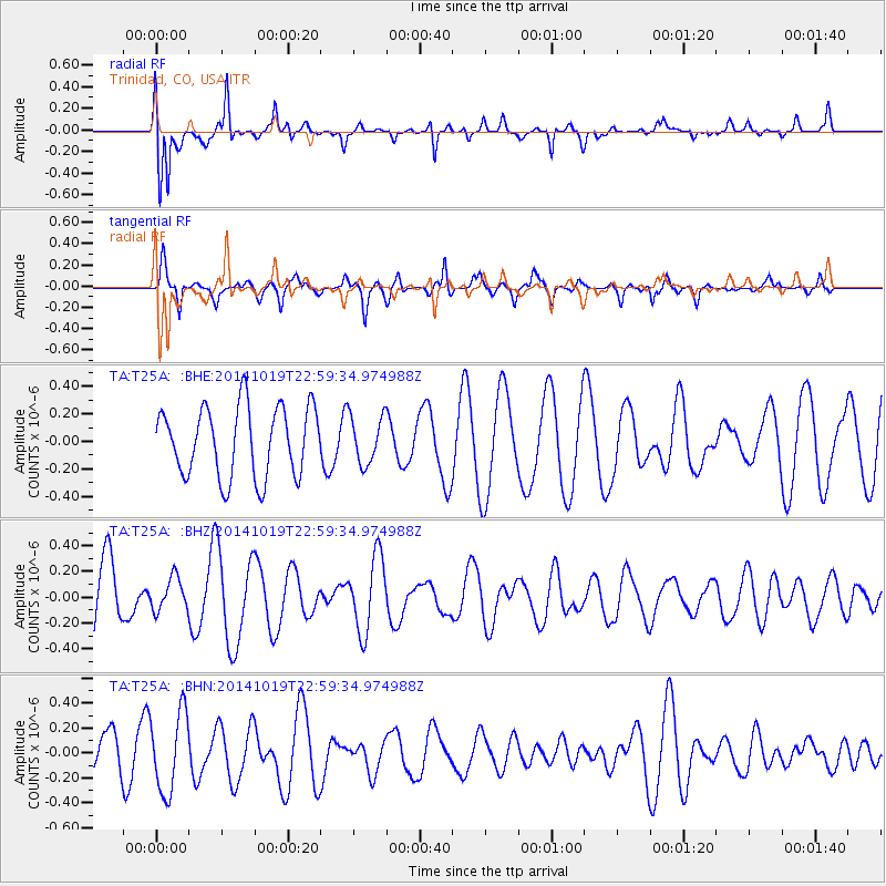
T25A Trinidad, CO, USA - Earthquake Result Viewer
*The percent match for this event was below the threshold and hence no stack was calculated.
| Earthquake location: |
North Of Ascension Island |
| Earthquake latitude/longitude: |
-1.1/-12.5 |
| Earthquake time(UTC): |
2014/10/19 (292) 22:46:56 GMT |
| Earthquake Depth: |
10 km |
| Earthquake Magnitude: |
4.9 MW |
| Earthquake Catalog/Contributor: |
ISC/ISC |
|
| Network: |
TA USArray Transportable Network (new EarthScope stations) |
| Station: |
T25A Trinidad, CO, USA |
| Lat/Lon: |
37.14 N/104.41 W |
| Elevation: |
2017 m |
|
| Distance: |
92.2 deg |
| Az: |
306.942 deg |
| Baz: |
89.689 deg |
| Ray Param: |
$rayparam |
*The percent match for this event was below the threshold and hence was not used in the summary stack. |
|
| Radial Match: |
80.45594 % |
| Radial Bump: |
346 |
| Transverse Match: |
67.67556 % |
| Transverse Bump: |
400 |
| SOD ConfigId: |
3390531 |
| Insert Time: |
2019-04-14 15:28:36.038 +0000 |
| GWidth: |
2.5 |
| Max Bumps: |
400 |
| Tol: |
0.001 |
|
Signal To Noise
| Channel | StoN | STA | LTA |
| TA:T25A: :BHZ:20141019T22:59:34.974988Z | 0.5484896 | 1.271996E-7 | 2.3190887E-7 |
| TA:T25A: :BHN:20141019T22:59:34.974988Z | 2.3509629 | 3.1982995E-7 | 1.360421E-7 |
| TA:T25A: :BHE:20141019T22:59:34.974988Z | 0.68246377 | 1.7320141E-7 | 2.5378844E-7 |
| Arrivals |
| Ps | |
| PpPs | |
| PsPs/PpSs | |


