You are here: Home > Network List > US - United States National Seismic Network Stations List
> Station WMOK Wichita Mountains, Oklahoma, USA > Earthquake Result Viewer
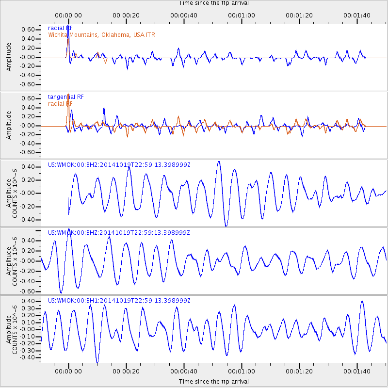
WMOK Wichita Mountains, Oklahoma, USA - Earthquake Result Viewer
*The percent match for this event was below the threshold and hence no stack was calculated.
| Earthquake location: |
North Of Ascension Island |
| Earthquake latitude/longitude: |
-1.1/-12.5 |
| Earthquake time(UTC): |
2014/10/19 (292) 22:46:56 GMT |
| Earthquake Depth: |
10 km |
| Earthquake Magnitude: |
4.9 MW |
| Earthquake Catalog/Contributor: |
ISC/ISC |
|
| Network: |
US United States National Seismic Network |
| Station: |
WMOK Wichita Mountains, Oklahoma, USA |
| Lat/Lon: |
34.74 N/98.78 W |
| Elevation: |
486 m |
|
| Distance: |
87.6 deg |
| Az: |
304.656 deg |
| Baz: |
92.977 deg |
| Ray Param: |
$rayparam |
*The percent match for this event was below the threshold and hence was not used in the summary stack. |
|
| Radial Match: |
53.32106 % |
| Radial Bump: |
400 |
| Transverse Match: |
62.002842 % |
| Transverse Bump: |
400 |
| SOD ConfigId: |
3390531 |
| Insert Time: |
2019-04-14 15:29:06.591 +0000 |
| GWidth: |
2.5 |
| Max Bumps: |
400 |
| Tol: |
0.001 |
|
Signal To Noise
| Channel | StoN | STA | LTA |
| US:WMOK:00:BHZ:20141019T22:59:13.398999Z | 2.754807 | 4.1664345E-7 | 1.5124233E-7 |
| US:WMOK:00:BH1:20141019T22:59:13.398999Z | 1.5086954 | 2.0732965E-7 | 1.3742313E-7 |
| US:WMOK:00:BH2:20141019T22:59:13.398999Z | 1.1569451 | 2.2194672E-7 | 1.918386E-7 |
| Arrivals |
| Ps | |
| PpPs | |
| PsPs/PpSs | |


