You are here: Home > Network List > IU - Global Seismograph Network (GSN - IRIS/USGS) Stations List
> Station RSSD Black Hills, South Dakota, USA > Earthquake Result Viewer
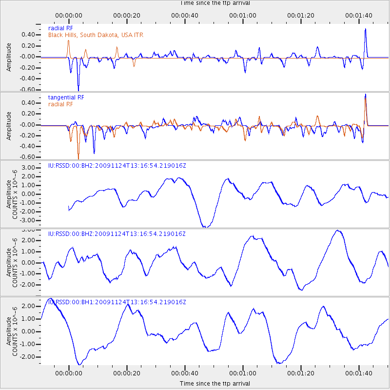
RSSD Black Hills, South Dakota, USA - Earthquake Result Viewer
*The percent match for this event was below the threshold and hence no stack was calculated.
| Earthquake location: |
Tonga Islands |
| Earthquake latitude/longitude: |
-20.7/-174.0 |
| Earthquake time(UTC): |
2009/11/24 (328) 13:04:22 GMT |
| Earthquake Depth: |
10 km |
| Earthquake Magnitude: |
5.6 MB |
| Earthquake Catalog/Contributor: |
WHDF/NEIC |
|
| Network: |
IU Global Seismograph Network (GSN - IRIS/USGS) |
| Station: |
RSSD Black Hills, South Dakota, USA |
| Lat/Lon: |
44.12 N/104.04 W |
| Elevation: |
2090 m |
|
| Distance: |
90.7 deg |
| Az: |
42.587 deg |
| Baz: |
241.61 deg |
| Ray Param: |
$rayparam |
*The percent match for this event was below the threshold and hence was not used in the summary stack. |
|
| Radial Match: |
47.146416 % |
| Radial Bump: |
343 |
| Transverse Match: |
58.256145 % |
| Transverse Bump: |
400 |
| SOD ConfigId: |
617450 |
| Insert Time: |
2013-09-30 19:50:44.758 +0000 |
| GWidth: |
2.5 |
| Max Bumps: |
400 |
| Tol: |
0.001 |
|
Signal To Noise
| Channel | StoN | STA | LTA |
| IU:RSSD:00:BHZ:20091124T13:16:54.219016Z | 1.5828379 | 1.0560433E-6 | 6.671835E-7 |
| IU:RSSD:00:BH1:20091124T13:16:54.219016Z | 1.7125256 | 1.7979096E-6 | 1.0498585E-6 |
| IU:RSSD:00:BH2:20091124T13:16:54.219016Z | 2.136848 | 1.4326284E-6 | 6.7044E-7 |
| Arrivals |
| Ps | |
| PpPs | |
| PsPs/PpSs | |


